|
search place name
|
||
Chindeya (Eastern, Zambia)Chindeya is a town in the Eastern region of Zambia. An overview map of the region around Chindeya is displayed below.
regional and 3d topo map of Chindeya, Zambia ::

Chindeya airports ::
The nearest airport is MFU - Mfuwe, located 80.0 km west of Chindeya.
Other airports nearby include LLW - Lilongwe Kamuzu Intl (129.4 km east), ZZU - Mzuzu (258.1 km north east), Nearby towns ::
Kwawa (1.9km south) //
Katawa (2.6km north west) //
Mphofu (3.6km west) //
Mfipa (3.6km west) //
Chilimbika (4.1km north east) //
Chitandika (4.1km north west) //
Mangulu (4.1km north west) //
Chaola (5.2km north east) //
Kambani (5.4km east) //
Chizuma (5.4km east) //
Katongwe (5.6km south) //
Mgombe (5.7km east) //
Chilindira (5.8km north) //
Kanyandula (5.8km north) //
Gama (5.8km south) //
Chimwala (5.8km south) //
Kamungu (5.8km south) //
Msakanya (5.8km south) //
Chamoto (5.7km west) //
Kanyendula (5.8km north) //
Kaluwa (6.6km north east) //
Dima (6.6km north east) //
Nkuntwa (6.6km south west) //
Mafuta (7.2km east) //
Ntambazina (7.4km south) //
Jembe (7.6km south) //
Mgawa (7.6km north) //
Kalwawe (7.8km south east) //
Joase Suma (7.8km south east) //
[all distances 'as the bird flies' and approximate] 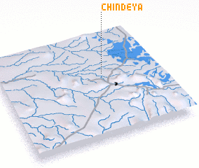 Places with similar names to Chindeya, Zambia ::
Disclaimer :: Information on this page comes without warranty of any kind |
||
|
Where is Chindeya? Elevation and coordinates ::
Latitude (lat): 13°22'0"S Longitude (lon): 32°40'0"E
Elevation (approx.): 952m (map arrows pan, magnifying glasses zoom) |
||
|
Visiting Chindeya? Hotel/Accommodation ::
Book a hotel in Chindeya Travel Guide ::
Buy a travel guide for Zambia rental cars ::
car rental offers GPS waypoint ::
download a GPX waypoint (PoI) of Chindeya for your GPS receiver
|
||