|
search place name
|
||
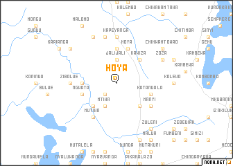
Hoya (Eastern, Zambia)Hoya is a town in the Eastern region of Zambia. An overview map of the region around Hoya is displayed below.
regional and 3d topo map of Hoya, Zambia ::
Hoya airports ::
The nearest airport is ZZU - Mzuzu, located 122.1 km north east of Hoya.
Other airports nearby include MFU - Mfuwe (180.0 km south west), LLW - Lilongwe Kamuzu Intl (193.9 km south), Nearby towns ::
Chiwoula (2.6km south west) //
Jalijali (3.7km north) //
Kanyanyata (3.7km north) //
Mtiwa (4.1km south west) //
Chimnyonto (4.1km south west) //
Chuavla (4.1km south west) //
Chimpesia (5.2km south west) //
Chiona (5.2km south east) //
Chitali (5.2km north east) //
Kawiza (5.2km north east) //
Chilowa (5.4km west) //
Kajinta (5.6km north) //
Ngwata (5.7km west) //
Moya (5.8km north) //
Katandala (5.7km east) //
Mutiwa (6.6km south west) //
Manyi (6.6km south east) //
Zibalwe (7.2km west) //
Kapeyanga (7.4km north) //
Kapepeya (7.6km north) //
Chikoya (8.3km north west) //
Gumba (8.1km north east) //
Zoza (8.1km north east) //
Chiponde (9.1km north west) //
Chimwamtowao (9.1km north east) //
Zuleni (9.2km south east) //
[all distances 'as the bird flies' and approximate] 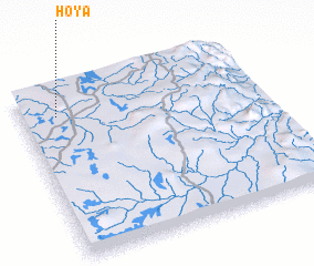 Places with similar names to Hoya, Zambia ::
Disclaimer :: Information on this page comes without warranty of any kind |
||
|
Where is Hoya? Elevation and coordinates ::
Latitude (lat): 12°9'0"S Longitude (lon): 33°9'0"E
Elevation (approx.): 1134m (map arrows pan, magnifying glasses zoom) |
||
|
Visiting Hoya? Hotel/Accommodation ::
Book a hotel in Hoya Travel Guide ::
Buy a travel guide for Zambia rental cars ::
car rental offers GPS waypoint ::
download a GPX waypoint (PoI) of Hoya for your GPS receiver
|
||