|
search place name
|
||
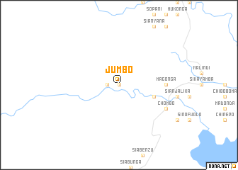
Jumbo (Southern, Zambia)Jumbo is a town in the Southern region of Zambia. An overview map of the region around Jumbo is displayed below.
regional and 3d topo map of Jumbo, Zambia ::
Jumbo airports ::
The nearest airport is KAB - Kariba Intl, located 131.1 km east of Jumbo.
Other airports nearby include LUN - Lusaka Intl (178.9 km north east), WKM - Hwange National Park (217.9 km south), LVI - Livingstone (229.7 km south west), VFA - Victoria Falls Intl (245.0 km south west), Nearby towns ::
Siabamba (0.0km north) //
Siampande (0.0km north) //
Siamalunda (1.8km west) //
Siamuluwa (1.8km west) //
Siamakwane (5.6km east) //
Magonga (7.1km east) //
Chombo (8.0km south east) //
[all distances 'as the bird flies' and approximate] 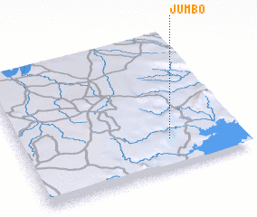 Places with similar names to Jumbo, Zambia ::
Disclaimer :: Information on this page comes without warranty of any kind |
||
|
Where is Jumbo? Elevation and coordinates ::
Latitude (lat): 16°46'0"S Longitude (lon): 27°41'0"E
Elevation (approx.): 559m (map arrows pan, magnifying glasses zoom) |
||
|
Visiting Jumbo? Hotel/Accommodation ::
Book a hotel in Jumbo Travel Guide ::
Buy a travel guide for Zambia rental cars ::
car rental offers GPS waypoint ::
download a GPX waypoint (PoI) of Jumbo for your GPS receiver
|
||