|
search place name
|
||
Kalengozola (North-Western, Zambia)Kalengozola is a town in the North-Western region of Zambia. An overview map of the region around Kalengozola is displayed below.
regional and 3d topo map of Kalengozola, Zambia ::
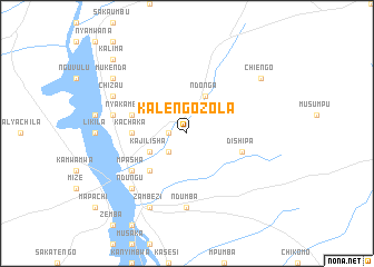
Nearby towns ::
Mulombwe (1.8km west) //
Mfumwayilolu (2.6km south west) //
Libala (2.6km south west) //
Kajilisha (4.1km south west) //
Ndonga (4.1km north east) //
Katoha (5.2km south west) //
Kachaka (5.4km west) //
Nyakambumba (5.7km west) //
Kawangu (5.7km west) //
Dishipa (5.7km east) //
Kaposa (6.6km south west) //
Mpasha (6.6km south west) //
Kawocha (7.4km south) //
Ndumba (7.4km south) //
Ntoka (7.4km west) //
Mukendenge (7.8km south west) //
Ndungu (7.8km south west) //
Lilunda (7.8km south west) //
Chiyesu (8.1km north west) //
Chizau (8.1km north west) //
Zambezi (8.2km south west) //
Mukenda (9.1km north west) //
Mbimbi (9.1km north west) //
Chiengo (9.1km north east) //
Kalima (10.3km north west) //
[all distances 'as the bird flies' and approximate] 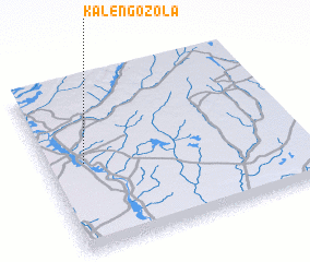 Places with similar names to Kalengozola, Zambia ::
// Kalongosola (CD)
// Klinča Sela (HR)
Disclaimer :: Information on this page comes without warranty of any kind |
||
|
Where is Kalengozola? Elevation and coordinates ::
Latitude (lat): 13°29'0"S Longitude (lon): 23°9'0"E
Elevation (approx.): 1085m (map arrows pan, magnifying glasses zoom) |
||
|
Visiting Kalengozola? Hotel/Accommodation ::
Book a hotel in Kalengozola Travel Guide ::
Buy a travel guide for Zambia rental cars ::
car rental offers GPS waypoint ::
download a GPX waypoint (PoI) of Kalengozola for your GPS receiver
|
||