|
search place name
|
||
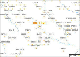
Katekwe (Eastern, Zambia)Katekwe is a town in the Eastern region of Zambia. An overview map of the region around Katekwe is displayed below.
regional and 3d topo map of Katekwe, Zambia ::
Katekwe airports ::
The nearest airport is MFU - Mfuwe, located 144.6 km north of Katekwe.
Nearby towns ::
Kani (0.0km north) //
Chilembwe (0.0km north) //
Kambo (1.8km west) //
Nyamulopa (1.9km south) //
Masukamika (2.6km south east) //
Ndombi (3.7km south) //
Kafimakina (4.1km north west) //
Chalokwa (5.6km south) //
Nzoole (5.6km south) //
Mankomba (5.8km south) //
Makina (5.8km north) //
Nyonyo (5.7km west) //
Kanjala (6.5km north west) //
Chikankala (6.5km south west) //
Kamwiri (6.5km north west) //
Nyamphanza (6.5km south east) //
Rubeni (6.5km south east) //
Kainzi (6.5km north east) //
Tolongo (6.5km north east) //
Chilawira (6.5km north east) //
Sulika (6.6km south east) //
Kolwe (7.4km south) //
Mturulaizi (7.6km south) //
Mulyanyungu (7.6km north) //
Mkum Ngombe (7.6km south) //
Mariko (7.7km south west) //
Ndombi (7.7km north east) //
Kampiripiri (8.1km north east) //
Mfuse (8.1km south west) //
[all distances 'as the bird flies' and approximate] 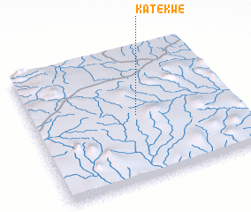 Places with similar names to Katekwe, Zambia ::
Disclaimer :: Information on this page comes without warranty of any kind |
||
|
Where is Katekwe? Elevation and coordinates ::
Latitude (lat): 14°30'0"S Longitude (lon): 31°31'0"E
Elevation (approx.): 1022m (map arrows pan, magnifying glasses zoom) |
||
|
Visiting Katekwe? Hotel/Accommodation ::
Book a hotel in Katekwe Travel Guide ::
Buy a travel guide for Zambia rental cars ::
car rental offers GPS waypoint ::
download a GPX waypoint (PoI) of Katekwe for your GPS receiver
|
||