|
search place name
|
||
Mukoshya Chita (Central, Zambia)Mukoshya Chita is a town in the Central region of Zambia. An overview map of the region around Mukoshya Chita is displayed below.
regional and 3d topo map of Mukoshya Chita, Zambia ::

Mukoshya Chita airports ::
The nearest airport is MFU - Mfuwe, located 117.6 km east of Mukoshya Chita.
Nearby towns ::
Amos Kapeta (1.9km north) //
Joseph Chitupila (1.8km west) //
Joseph Kalikenka (1.9km south) //
Eliya Kasonde (2.6km north west) //
Kawaya (2.6km north west) //
Lomas Mulenga (4.1km north east) //
Chibale (4.1km north east) //
Joni Chapa (4.1km south east) //
Malasa (5.2km north east) //
Lamak Miya (5.2km north east) //
Maliko Kabepule (5.2km north east) //
Philipo (5.2km north east) //
Laija Mwapa (5.4km east) //
Chai Bela (5.4km east) //
Bashiluma (5.7km west) //
Joni Chita (5.7km west) //
Lailo Musoshya (5.7km east) //
Sala Kunda (6.6km north west) //
Mailo (6.6km north east) //
Joseph Kalonga (6.6km north west) //
Sayoni Msasa (6.6km south east) //
Namwape (6.6km south east) //
Masansa (7.2km west) //
Jesse Sambwa (7.5km east) //
Chiputwa (7.8km south west) //
Dixon Malwita (7.8km south west) //
Makofi Kunda (8.1km north east) //
Dixon Kapinda (8.2km north west) //
Nakatuta (8.1km south east) //
[all distances 'as the bird flies' and approximate] 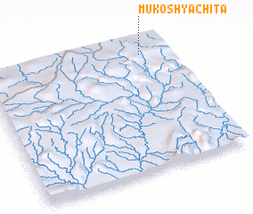 Places with similar names to Mukoshya Chita, Zambia :: Disclaimer :: Information on this page comes without warranty of any kind |
||
|
Where is Mukoshya Chita? Elevation and coordinates ::
Latitude (lat): 13°5'0"S Longitude (lon): 30°52'0"E
Elevation (approx.): 1601m (map arrows pan, magnifying glasses zoom) |
||
|
Visiting Mukoshya Chita? Hotel/Accommodation ::
Book a hotel in Mukoshya Chita Travel Guide ::
Buy a travel guide for Zambia rental cars ::
car rental offers GPS waypoint ::
download a GPX waypoint (PoI) of Mukoshya Chita for your GPS receiver
|
||