|
search place name
|
||
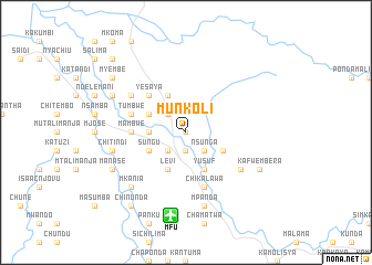
Munkoli (Eastern, Zambia)Munkoli is a town in the Eastern region of Zambia. An overview map of the region around Munkoli is displayed below.
regional and 3d topo map of Munkoli, Zambia ::
Munkoli airports ::
The nearest airport is MFU - Mfuwe, located 8.5 km south of Munkoli.
Other airports nearby include LLW - Lilongwe Kamuzu Intl (209.3 km east), Nearby towns ::
Makunganya (0.0km north) //
Kavimba (1.9km south) //
Pembe (2.6km north west) //
Nelsoni (2.6km south west) //
Nsunga (2.6km south east) //
Imedi (3.6km west) //
Fundi (4.1km north west) //
Kazandwe (4.1km north west) //
Chikumba (4.1km north west) //
Chintunzi (4.1km north west) //
Samson (4.1km north west) //
Chikomangana (4.1km north west) //
Sungu (4.1km south west) //
Mazangwe (4.1km south east) //
Chikazi (4.1km south west) //
Kasinje (4.1km south west) //
Levi (4.1km south west) //
Yusuf (4.1km south east) //
Yesaya (5.2km north west) //
Mambwe (5.4km west) //
Chiwawatala (5.7km west) //
Tumbwe (5.7km west) //
Chikalawa (5.8km south) //
Mwanza (6.6km north west) //
Nsefu (6.6km north west) //
Ledman Kamanga (6.6km south east) //
Chitindi (7.5km west) //
Mpanda (7.6km south) //
Mkania (7.8km south west) //
[all distances 'as the bird flies' and approximate] 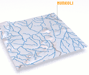 Places with similar names to Munkoli, Zambia ::
// Managale (MM)
// Mangla (MM)
// Mān Ka-lao (MM)
// Mān Kalu (MM)
// Mān Nawkla (MM)
// Maungla (MM)
// Maunglaw (MM)
// Mingala (MM)
// Mingala (MM)
// Möng La (MM)
Disclaimer :: Information on this page comes without warranty of any kind |
||
|
Where is Munkoli? Elevation and coordinates ::
Latitude (lat): 13°11'0"S Longitude (lon): 31°57'0"E
Elevation (approx.): 561m (map arrows pan, magnifying glasses zoom) |
||
|
Visiting Munkoli? Hotel/Accommodation ::
Book a hotel in Munkoli Travel Guide ::
Buy a travel guide for Zambia rental cars ::
car rental offers GPS waypoint ::
download a GPX waypoint (PoI) of Munkoli for your GPS receiver
|
||