|
search place name
|
||
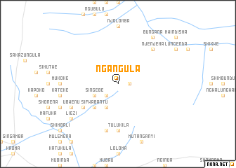
Ngangula (Western, Zambia)Ngangula is a town in the Western region of Zambia. An overview map of the region around Ngangula is displayed below.
regional and 3d topo map of Ngangula, Zambia ::
Nearby towns ::
Shizheka (1.8km east) //
Mulamba (2.6km south west) //
Singebe (4.0km south west) //
Chikwekwe (4.1km south west) //
Mambwe (4.1km south west) //
Sifwabantu (5.2km south west) //
Kalenge (5.2km south west) //
Mandumba (6.5km south west) //
Mutita (6.5km south west) //
Kangombe (7.4km south) //
Tulukila (7.4km south) //
Sibidi (7.6km south) //
Njenjema (7.7km north east) //
Ubwenu (8.1km south west) //
Bungana (9.2km north east) //
Mwangalala (9.2km north east) //
Liezi (9.1km south west) //
Kakumbi (9.1km south west) //
[all distances 'as the bird flies' and approximate] 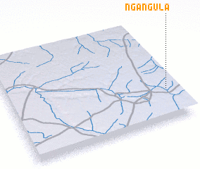 Places with similar names to Ngangula, Zambia ::
// Nkangala (ZA)
// Nkangala (ZA)
// Ngangouali (TD)
// Ngangula (CD)
// Ngangula (CD)
// Ngongolo (CD)
// Ngouangala (CG)
// Ngouangala (CG)
// Ngongolo (UG)
// Ngankal (SN)
Disclaimer :: Information on this page comes without warranty of any kind |
||
|
Where is Ngangula? Elevation and coordinates ::
Latitude (lat): 14°41'0"S Longitude (lon): 24°57'0"E
Elevation (approx.): 1182m (map arrows pan, magnifying glasses zoom) |
||
|
Visiting Ngangula? Hotel/Accommodation ::
Book a hotel in Ngangula Travel Guide ::
Buy a travel guide for Zambia rental cars ::
car rental offers GPS waypoint ::
download a GPX waypoint (PoI) of Ngangula for your GPS receiver
|
||