|
search place name
|
||
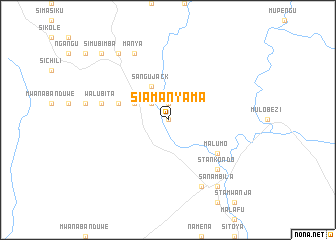
Siamanyama (Western, Zambia)Siamanyama is a town in the Western region of Zambia. An overview map of the region around Siamanyama is displayed below.
regional and 3d topo map of Siamanyama, Zambia ::
Siamanyama airports ::
The nearest airport is BBK - Kasane, located 116.6 km south of Siamanyama.
Other airports nearby include LVI - Livingstone (140.2 km south east), VFA - Victoria Falls Intl (166.8 km south east), WKM - Hwange National Park (291.1 km south east), Nearby towns ::
Samitunta (0.0km north) //
Sangombe (1.9km north) //
Mabuku (2.6km north west) //
Sangu Jack (4.1km north west) //
Muchokachimongo (4.0km north west) //
Kalimukwa (4.0km north west) //
Siamasambo (5.6km west) //
Malumo (6.5km south east) //
Kapatama (6.5km south east) //
Siamwanja (7.3km west) //
Kalumbwa (7.3km west) //
Walubita (7.3km west) //
Songuzu (7.7km south east) //
Maleya Namindi (7.7km south east) //
Stankondo (7.7km south east) //
Sichinji (7.7km south east) //
Likunde (8.2km north west) //
Manya (8.2km north west) //
Kalukwa (8.2km north west) //
Liwale (8.2km north west) //
Machili (8.2km south east) //
Kalaluka (9.1km north west) //
Sanambila (9.1km south east) //
Mulamfu (9.1km south east) //
Mulafu (9.1km south east) //
Mukwokwo (9.1km south east) //
Kalamba (9.1km south east) //
Mulengwa (10.3km north west) //
Siatulila (10.3km north west) //
[all distances 'as the bird flies' and approximate] 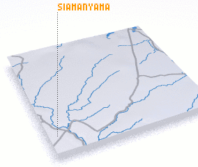 Places with similar names to Siamanyama, Zambia :: Disclaimer :: Information on this page comes without warranty of any kind |
||
|
Where is Siamanyama? Elevation and coordinates ::
Latitude (lat): 16°47'0"S Longitude (lon): 25°4'0"E
Elevation (approx.): 1005m (map arrows pan, magnifying glasses zoom) |
||
|
Visiting Siamanyama? Hotel/Accommodation ::
Book a hotel in Siamanyama Travel Guide ::
Buy a travel guide for Zambia rental cars ::
car rental offers GPS waypoint ::
download a GPX waypoint (PoI) of Siamanyama for your GPS receiver
|
||