|
search place name
|
||
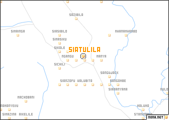
Siatulila (Western, Zambia)Siatulila is a town in the Western region of Zambia. An overview map of the region around Siatulila is displayed below.
regional and 3d topo map of Siatulila, Zambia ::
Siatulila airports ::
The nearest airport is BBK - Kasane, located 124.7 km south of Siatulila.
Other airports nearby include LVI - Livingstone (150.4 km south east), VFA - Victoria Falls Intl (176.8 km south east), Nearby towns ::
Mulengwa (0.0km north) //
Simubimba (0.0km north) //
Simulubwa (1.8km west) //
Kalaluka (1.8km east) //
Liwale (3.5km east) //
Kalukwa (3.5km east) //
Likulunga (3.5km west) //
Ngʼangu (3.5km west) //
Manya (3.5km east) //
Likunde (3.5km east) //
Lukomeno (4.0km north west) //
Siamwanja (5.6km south) //
Kalumbwa (5.6km south) //
Walubita (5.6km south) //
Sichili (5.6km west) //
Sinyanga (5.8km south) //
Ngungula (5.8km south) //
Siamasambo (5.8km south) //
Sikole (5.6km west) //
Sianzofu (6.6km south west) //
Kalimukwa (6.6km south east) //
Muchokachimongo (6.6km south east) //
Chabenge (6.6km south west) //
Sangu Jack (6.5km south east) //
Sanzila (6.5km north west) //
Sikaneta (6.5km north west) //
Simasiku (6.5km north west) //
Mwanabanduwe (7.7km south west) //
Mabuku (7.7km south east) //
[all distances 'as the bird flies' and approximate] 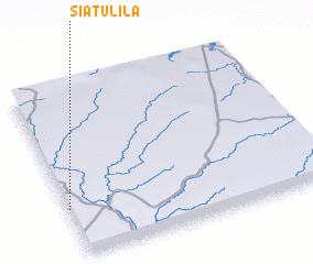 Places with similar names to Siatulila, Zambia ::
Disclaimer :: Information on this page comes without warranty of any kind |
||
|
Where is Siatulila? Elevation and coordinates ::
Latitude (lat): 16°43'0"S Longitude (lon): 25°0'0"E
Elevation (approx.): 1022m (map arrows pan, magnifying glasses zoom) |
||
|
Visiting Siatulila? Hotel/Accommodation ::
Book a hotel in Siatulila Travel Guide ::
Buy a travel guide for Zambia rental cars ::
car rental offers GPS waypoint ::
download a GPX waypoint (PoI) of Siatulila for your GPS receiver
|
||