|
search place name
|
||
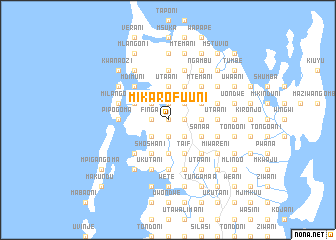
Mikarofuuni (Tanzania)Mikarofuuni is a town in Tanzania. An overview map of the region around Mikarofuuni is displayed below.
regional and 3d topo map of Mikarofuuni, Tanzania ::
Mikarofuuni airports ::
The nearest airport is PMA - Pemba, located 30.3 km south of Mikarofuuni.
Other airports nearby include TGT - Tanga (72.3 km west), MBA - Mombasa Moi Intl (107.6 km north), ZNZ - Zanzibar (145.7 km south), DAR - Dar Es Salaam Mwalimu Julius K Nyerere Intl (215.4 km south), Nearby towns ::
Makombani (0.0km north) //
Mgogoni (1.8km east) //
Gongo (1.8km east) //
Tondoni (1.8km east) //
Tuliani (1.8km west) //
Finga (1.8km west) //
Kidimui (1.8km west) //
Junguni (1.8km west) //
Mzabibo (1.9km north) //
Gongo (1.9km south) //
Kirwa (1.9km south) //
Mkote (1.9km south) //
Pwani (1.9km north) //
Mpakani (1.9km north) //
Michikichini (1.9km south) //
Mtemani (2.6km north east) //
Kisiwani (2.6km south east) //
Msuka (2.6km north east) //
Kombani (2.6km north east) //
Utaani (2.6km north west) //
Ukutani (2.6km south west) //
Bondeni (2.6km north west) //
Mwembeni (2.6km north west) //
Gando (2.6km north west) //
Sinawe (2.6km north west) //
Magogoni (2.6km north west) //
Kish Kash (2.6km south west) //
Chanje (2.6km south west) //
Raha (3.7km south) //
[all distances 'as the bird flies' and approximate] 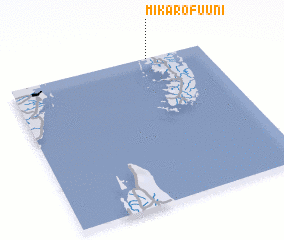 Places with similar names to Mikarofuuni, Tanzania ::
// Mokorvon (CM)
// McRaven (US)
// Māgurāghona (BD)
// Maikurfuna (NG)
// Mukhrovani (GE)
// Makravan (AM)
// Ma-karrifon (SL)
Disclaimer :: Information on this page comes without warranty of any kind |
||
|
Where is Mikarofuuni? Elevation and coordinates ::
Latitude (lat): 5°0'0"S Longitude (lon): 39°43'0"E
Elevation (approx.): 57m (map arrows pan, magnifying glasses zoom) |
||
|
Visiting Mikarofuuni? Hotel/Accommodation ::
Book a hotel in Mikarofuuni Travel Guide ::
Buy a travel guide for Tanzania rental cars ::
car rental offers GPS waypoint ::
download a GPX waypoint (PoI) of Mikarofuuni for your GPS receiver
|
||