|
search place name
|
||
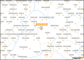
Bahama (Southern, Sierra Leone)Bahama is a town in the Southern region of Sierra Leone. An overview map of the region around Bahama is displayed below.
regional and 3d topo map of Bahama, Sierra Leone ::
Bahama airports ::
The nearest airport is FNA - Freetown Lungi, located 112.4 km west of Bahama.
Other airports nearby include FAA - Faranah (252.7 km north east), MLW - Monrovia Spriggs Payne (273.4 km south east), Nearby towns ::
Waterloo (2.0km north west) //
Jurma (3.2km south east) //
Gendema (4.4km south west) //
Tongbai (4.5km north west) //
Kondayama Junction (4.7km north) //
Gbap (4.8km south) //
Moyamba Junction (5.1km north east) //
Jagbahun (5.4km west) //
Bangoma (5.7km south west) //
Gbogonma (5.7km east) //
Gbonumbu (5.7km east) //
Panguma (5.9km north west) //
Kangahun (5.9km south east) //
Jajubu (6.5km south east) //
Buya (7.1km north west) //
Gendema (7.2km west) //
Benduma (7.3km west) //
Banda (7.4km south) //
Gbane (7.4km south east) //
Gbengbebu (7.7km west) //
Mokiri (7.7km west) //
Mokebi (8.0km east) //
Majundu (8.5km south west) //
Manjawo (9.1km south east) //
Makump (9.7km north west) //
Petema (9.8km south west) //
Siena (9.8km south east) //
Mafan (10.0km north west) //
Mafenti (10.0km north east) //
[all distances 'as the bird flies' and approximate] 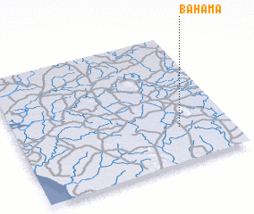 Places with similar names to Bahama, Sierra Leone ::
Disclaimer :: Information on this page comes without warranty of any kind |
||
|
Where is Bahama? Elevation and coordinates ::
Latitude (lat): 8°16'27"N Longitude (lon): 12°14'5"W
Elevation (approx.): 72m (map arrows pan, magnifying glasses zoom) |
||
|
Visiting Bahama? Hotel/Accommodation ::
Book a hotel in Bahama Travel Guide ::
rental cars ::
car rental offers GPS waypoint ::
download a GPX waypoint (PoI) of Bahama for your GPS receiver
|
||