|
search place name
|
||
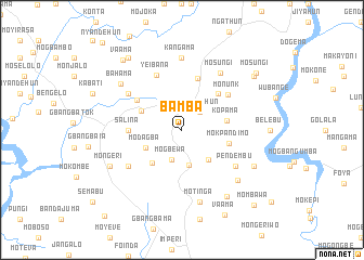
Bamba (Southern, Sierra Leone)Bamba is a town in the Southern region of Sierra Leone. An overview map of the region around Bamba is displayed below.
regional and 3d topo map of Bamba, Sierra Leone ::
Bamba airports ::
The nearest airport is FNA - Freetown Lungi, located 135.1 km north west of Bamba.
Other airports nearby include MLW - Monrovia Spriggs Payne (237.3 km south east), ROB - Monrovia Roberts Intl (274.0 km south east), Nearby towns ::
Nyandehun (2.6km north east) //
Mogbewa (3.3km south) //
Petema (3.7km south) //
Ndendemoia (4.1km south east) //
Modagba (4.1km south west) //
Mogbwemo (4.5km south west) //
Lago Junction (4.6km north west) //
Kopama (4.6km east) //
Mokpandimo (5.0km east) //
Mongawo (5.2km north east) //
Gondama (5.5km north) //
Salina (5.5km west) //
Mokanagbo (5.5km west) //
Lago (5.5km north west) //
Monunk (5.9km north east) //
Yeibana (6.2km north west) //
Gbangbaia (6.6km south west) //
Patema (6.6km north west) //
Pendembu (6.6km south east) //
Mosungi (7.1km north east) //
Kangama (7.4km north) //
Motinga (7.6km south) //
Mondoko (7.7km south east) //
Bahama (7.8km north west) //
Pejebu (8.2km south east) //
Hemabu (8.2km south east) //
Mongeri (8.2km south west) //
Mofindo (9.2km north east) //
Mosangawo (9.2km north west) //
[all distances 'as the bird flies' and approximate] 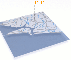 Places with similar names to Bamba, Sierra Leone ::
Disclaimer :: Information on this page comes without warranty of any kind |
||
|
Where is Bamba? Elevation and coordinates ::
Latitude (lat): 7°48'0"N Longitude (lon): 12°17'0"W
Elevation (approx.): 40m (map arrows pan, magnifying glasses zoom) |
||
|
Visiting Bamba? Hotel/Accommodation ::
Book a hotel in Bamba Travel Guide ::
rental cars ::
car rental offers GPS waypoint ::
download a GPX waypoint (PoI) of Bamba for your GPS receiver
|
||