|
search place name
|
||
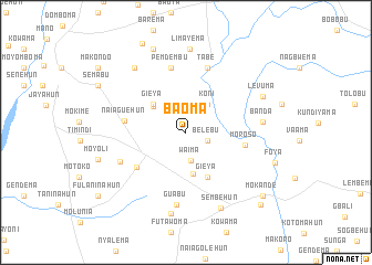
Baoma (Southern, Sierra Leone)Baoma is a town in the Southern region of Sierra Leone. An overview map of the region around Baoma is displayed below.
regional and 3d topo map of Baoma, Sierra Leone ::
Baoma airports ::
The nearest airport is FNA - Freetown Lungi, located 153.4 km north west of Baoma.
Other airports nearby include MLW - Monrovia Spriggs Payne (227.9 km south east), ROB - Monrovia Roberts Intl (260.5 km south east), Nearby towns ::
Belebu (2.4km east) //
Waima (2.9km south) //
Koni (3.6km north east) //
Fulawahun (4.2km north west) //
Ngukpabu (4.2km south) //
Gieya (4.4km north west) //
Gieya (5.0km south east) //
Moroso (6.0km east) //
Balahun (6.1km south west) //
Naiaguehun (6.3km west) //
Moyogbu (6.7km north) //
Pemdembu (6.7km north) //
Tabe (6.9km north) //
Moogiba (7.2km south west) //
Guabu (7.3km south) //
Banda (7.8km east) //
Gbenega (8.4km south) //
Nyandehun (8.3km north west) //
Limayema (8.4km north) //
Sembehun (8.4km south east) //
Levuma (8.5km north east) //
Salina (9.1km north) //
Moyoli (9.2km west) //
Mokande (10.0km south east) //
Semabu (10.0km north west) //
Kerebu (10.0km north west) //
Bumpe (10.4km south east) //
Fulaninahun (10.9km south west) //
Makondo (11.0km north west) //
[all distances 'as the bird flies' and approximate] 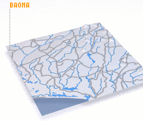 Places with similar names to Baoma, Sierra Leone ::
Disclaimer :: Information on this page comes without warranty of any kind |
||
|
Where is Baoma? Elevation and coordinates ::
Latitude (lat): 7°57'27"N Longitude (lon): 11°58'12"W
Elevation (approx.): 45m (map arrows pan, magnifying glasses zoom) |
||
|
Visiting Baoma? Hotel/Accommodation ::
Book a hotel in Baoma Travel Guide ::
rental cars ::
car rental offers GPS waypoint ::
download a GPX waypoint (PoI) of Baoma for your GPS receiver
|
||