|
search place name
|
||
Fuyero (Eastern, Sierra Leone)Fuyero is a town in the Eastern region of Sierra Leone. An overview map of the region around Fuyero is displayed below.
regional and 3d topo map of Fuyero, Sierra Leone ::

Fuyero airports ::
The nearest airport is FAA - Faranah, located 141.3 km north of Fuyero.
Nearby towns ::
Baradu (0.0km north) //
Fada (1.8km west) //
Fuidu (2.6km north east) //
Sefadu (2.6km south east) //
Sukudu (3.7km west) //
Kakpadu (3.7km south) //
Waidu (3.7km east) //
Kamadu (4.1km north west) //
Kurako (4.1km north west) //
Kpandakadu (4.1km south west) //
Kasikoia (4.1km north east) //
Kangama (4.1km north east) //
Buguma (4.1km south east) //
Baiama (5.2km south west) //
Sedu (5.5km west) //
Dandando (5.6km south) //
Gbamundu (5.9km north) //
Boma (5.9km south) //
Titambaia (5.8km west) //
Kafaidu (5.9km north) //
Kwidadu (6.7km south west) //
Kaikudu (7.3km west) //
Kenema (7.4km north) //
Yaradu (7.6km west) //
Komendinja (7.6km west) //
Woma (7.6km east) //
Gbangadu (7.6km east) //
Gbikundu (7.8km south west) //
Dangbwidu (7.8km south west) //
[all distances 'as the bird flies' and approximate] 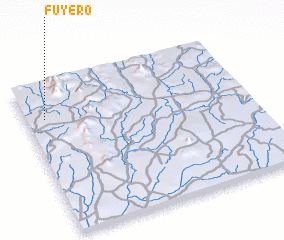 Places with similar names to Fuyero, Sierra Leone ::
Disclaimer :: Information on this page comes without warranty of any kind |
||
|
Where is Fuyero? Elevation and coordinates ::
Latitude (lat): 8°46'0"N Longitude (lon): 10°55'0"W
Elevation (approx.): 421m (map arrows pan, magnifying glasses zoom) |
||
|
Visiting Fuyero? Hotel/Accommodation ::
Book a hotel in Fuyero Travel Guide ::
rental cars ::
car rental offers GPS waypoint ::
download a GPX waypoint (PoI) of Fuyero for your GPS receiver
|
||