|
search place name
|
||
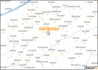
Koribundu (Southern, Sierra Leone)Koribundu is a town in the Southern region of Sierra Leone. An overview map of the region around Koribundu is displayed below.
regional and 3d topo map of Koribundu, Sierra Leone ::
Koribundu airports ::
The nearest airport is MLW - Monrovia Spriggs Payne, located 188.1 km south east of Koribundu.
Other airports nearby include FNA - Freetown Lungi (193.5 km north west), ROB - Monrovia Roberts Intl (219.8 km south east), Nearby towns ::
Kando (2.5km north west) //
Bendu (3.4km north) //
Lago (4.7km south east) //
Bandajuma (5.6km north east) //
Grima (5.5km west) //
Jambohun (5.9km north east) //
Blama (5.9km east) //
Buma (6.0km north west) //
Nyandehun (6.1km south west) //
Peyama (6.7km south) //
Mano (6.7km north west) //
Sogoma (6.9km east) //
Tikonkoworo (7.7km north west) //
Walihun (8.0km north east) //
Sulehun (8.0km north) //
Jagbwema (8.0km west) //
Sembehun (8.2km north west) //
Gaioura (8.3km south east) //
Petema (8.3km north east) //
Baomahun (8.6km north) //
Naiagolehun (8.6km west) //
Gombu (8.7km south) //
Yandehun (8.8km south east) //
Yandama (8.8km north west) //
Peteoma (9.3km south west) //
Mano (9.4km north east) //
Gorahun (10.0km north west) //
Majihun (11.0km north west) //
Kakama (11.3km south west) //
[all distances 'as the bird flies' and approximate]  Places with similar names to Koribundu, Sierra Leone ::
Disclaimer :: Information on this page comes without warranty of any kind |
||
|
Where is Koribundu? Elevation and coordinates ::
Latitude (lat): 7°42'41"N Longitude (lon): 11°41'32"W
Elevation (approx.): 76m (map arrows pan, magnifying glasses zoom) |
||
|
Visiting Koribundu? Hotel/Accommodation ::
Book a hotel in Koribundu Travel Guide ::
rental cars ::
car rental offers GPS waypoint ::
download a GPX waypoint (PoI) of Koribundu for your GPS receiver
|
||