|
search place name
|
||
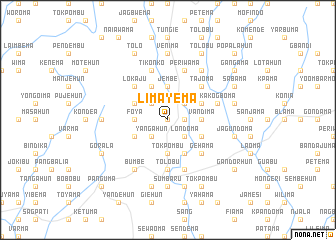
Limayema (Eastern, Sierra Leone)Limayema is a town in the Eastern region of Sierra Leone. An overview map of the region around Limayema is displayed below.
regional and 3d topo map of Limayema, Sierra Leone ::
Limayema airports ::
The nearest airport is FAA - Faranah, located 200.2 km north of Limayema.
Other airports nearby include MLW - Monrovia Spriggs Payne (219.5 km south), Nearby towns ::
Jagbahun (0.0km north) //
Komboma (1.8km east) //
Jaluahun (1.8km east) //
Petema (2.6km north west) //
Yangahun (2.6km south west) //
Taninahun (2.6km south east) //
Konjo (2.6km north east) //
Londoma (2.6km south east) //
Foya (3.7km west) //
Beshebu (3.7km west) //
Tokpombu (3.7km south) //
Jembe (3.7km north) //
Diwa (3.7km north) //
Pandobu (3.7km south) //
Vandima (3.7km east) //
Gohuma (4.1km north west) //
Majebu (4.1km north west) //
Mandahun (4.1km south west) //
Gorahun (4.1km north west) //
Pendehun (4.1km south east) //
Kotohun (4.1km north east) //
Kpolia (4.1km south east) //
Lokaju (5.2km north west) //
Tajoma (5.2km north east) //
Gehama (5.2km south east) //
Banda Bulima (5.2km north east) //
Tolobu (5.6km south) //
Tikonko (5.9km north) //
Galahun (5.9km north) //
[all distances 'as the bird flies' and approximate] 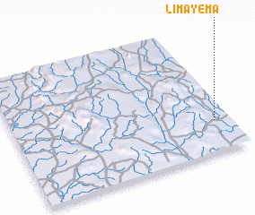
Disclaimer :: Information on this page comes without warranty of any kind |
||
|
Where is Limayema? Elevation and coordinates ::
Latitude (lat): 8°15'0"N Longitude (lon): 11°4'0"W
Elevation (approx.): 239m (map arrows pan, magnifying glasses zoom) |
||
|
Visiting Limayema? Hotel/Accommodation ::
Book a hotel in Limayema Travel Guide ::
rental cars ::
car rental offers GPS waypoint ::
download a GPX waypoint (PoI) of Limayema for your GPS receiver
|
||