|
search place name
|
||
Manowa (Southern, Sierra Leone)Manowa is a town in the Southern region of Sierra Leone. An overview map of the region around Manowa is displayed below.
regional and 3d topo map of Manowa, Sierra Leone ::

Manowa airports ::
The nearest airport is FNA - Freetown Lungi, located 199.5 km west of Manowa.
Other airports nearby include MLW - Monrovia Spriggs Payne (204.5 km south east), ROB - Monrovia Roberts Intl (230.7 km south east), Nearby towns ::
Kpumbu (1.6km south east) //
Kpetema (1.8km north) //
Kunju (3.7km west) //
Taninahun (3.9km south) //
Jagbwema (4.1km north west) //
Periwahun (4.1km north west) //
Laoma (4.1km north east) //
Benduma (4.1km north west) //
Blama (5.2km south west) //
Yamandu (5.4km south) //
Petewoma (5.5km west) //
Juhun (5.7km east) //
Kwelu (5.7km south west) //
Bangema (5.8km west) //
Kugbahun (5.9km north) //
Yankabu (5.9km north) //
Bundobu (7.4km south) //
Kondiama (7.4km north) //
Bumbe (7.3km west) //
Waima (7.6km south east) //
Ndogbogoma (7.6km south) //
Fala (7.6km north) //
Yakaji (7.6km east) //
Bangabu (7.6km west) //
Baiima (7.8km south west) //
Yengema (7.8km north west) //
Kpakru (8.3km south) //
Golala (8.3km south west) //
Gpa (8.2km south west) //
[all distances 'as the bird flies' and approximate] 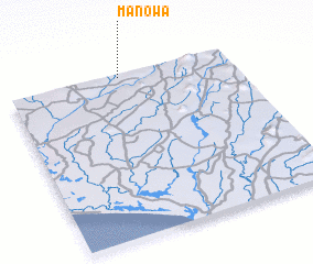 Places with similar names to Manowa, Sierra Leone ::
Disclaimer :: Information on this page comes without warranty of any kind |
||
|
Where is Manowa? Elevation and coordinates ::
Latitude (lat): 7°59'0"N Longitude (lon): 11°30'0"W
Elevation (approx.): 123m (map arrows pan, magnifying glasses zoom) |
||
|
Visiting Manowa? Hotel/Accommodation ::
Book a hotel in Manowa Travel Guide ::
rental cars ::
car rental offers GPS waypoint ::
download a GPX waypoint (PoI) of Manowa for your GPS receiver
|
||