|
search place name
|
||
Mawujo (Southern, Sierra Leone)Mawujo is a town in the Southern region of Sierra Leone. An overview map of the region around Mawujo is displayed below.
regional and 3d topo map of Mawujo, Sierra Leone ::

Mawujo airports ::
The nearest airport is FNA - Freetown Lungi, located 128.7 km north west of Mawujo.
Other airports nearby include MLW - Monrovia Spriggs Payne (245.4 km south east), ROB - Monrovia Roberts Intl (280.7 km south east), Nearby towns ::
Baoma (2.6km north east) //
Jagbahun (3.3km south west) //
Magbwema (3.7km north) //
Funkia (4.1km south east) //
Jagbahun (4.1km south west) //
Moyogbo (4.1km south east) //
Ngathun (4.8km south) //
Gibiabehun (5.2km south east) //
Mongeri (5.4km north) //
Kawaya (5.7km north west) //
Mojombo (5.8km west) //
Kabaima (6.8km north east) //
Naiagolehun (6.8km east) //
Wonkifu (7.3km east) //
Mobela (7.6km east) //
Taninahun (8.3km north) //
Kangama (8.3km south west) //
Kania (8.3km north west) //
Mojoka (8.2km south west) //
Foya (8.6km north east) //
Gambia (9.2km north west) //
Dogema (10.5km south east) //
Mofoyo (11.3km south east) //
[all distances 'as the bird flies' and approximate] 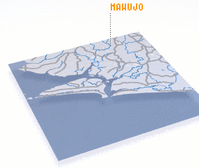 Places with similar names to Mawujo, Sierra Leone ::
Disclaimer :: Information on this page comes without warranty of any kind |
||
|
Where is Mawujo? Elevation and coordinates ::
Latitude (lat): 7°56'0"N Longitude (lon): 12°15'0"W
Elevation (approx.): 80m (map arrows pan, magnifying glasses zoom) |
||
|
Visiting Mawujo? Hotel/Accommodation ::
Book a hotel in Mawujo Travel Guide ::
rental cars ::
car rental offers GPS waypoint ::
download a GPX waypoint (PoI) of Mawujo for your GPS receiver
|
||