|
search place name
|
||
Monjema (Eastern, Sierra Leone)Monjema is a town in the Eastern region of Sierra Leone. An overview map of the region around Monjema is displayed below.
regional and 3d topo map of Monjema, Sierra Leone ::

Monjema airports ::
The nearest airport is FAA - Faranah, located 184.9 km north of Monjema.
Other airports nearby include FNA - Freetown Lungi (215.1 km west), Nearby towns ::
Motema (1.8km east) //
Guala (2.6km south east) //
Sumbaru (2.6km south west) //
Majundu (2.6km north west) //
Peyima (3.7km west) //
Malia (4.1km north east) //
Levuma (5.2km south west) //
Panguma (5.2km south east) //
Kpanpanbu (5.6km north) //
Guabu (5.6km north) //
Naiagolehun (5.8km west) //
Bandama (5.9km south) //
Langrama (5.9km south) //
Yombohun (5.8km west) //
Gpendeima (6.6km south east) //
Bahama (6.6km south west) //
Punduru (6.7km north west) //
Yombohun (6.6km north west) //
Kogbwendehun (7.6km west) //
Sandu (7.6km east) //
Dombadu (7.6km north) //
Pakpakia (7.8km south east) //
Tekwiama (7.8km south west) //
Matama (8.3km south east) //
Poyama (8.2km south west) //
Pujehun (8.3km north east) //
Peiya (8.3km north east) //
Taluke (9.2km south west) //
Tangabu (9.2km south east) //
[all distances 'as the bird flies' and approximate] 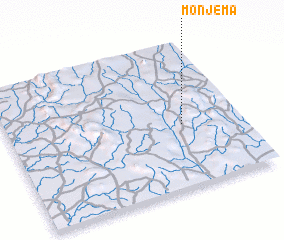 Places with similar names to Monjema, Sierra Leone ::
Disclaimer :: Information on this page comes without warranty of any kind |
||
|
Where is Monjema? Elevation and coordinates ::
Latitude (lat): 8°26'0"N Longitude (lon): 11°15'0"W
Elevation (approx.): 340m (map arrows pan, magnifying glasses zoom) |
||
|
Visiting Monjema? Hotel/Accommodation ::
Book a hotel in Monjema Travel Guide ::
rental cars ::
car rental offers GPS waypoint ::
download a GPX waypoint (PoI) of Monjema for your GPS receiver
|
||