|
search place name
|
||
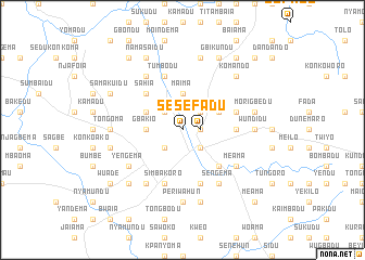
Sefadu (Eastern, Sierra Leone)Sefadu is a town in the Eastern region of Sierra Leone. An overview map of the region around Sefadu is displayed below.
regional and 3d topo map of Sefadu, Sierra Leone ::
Sefadu airports ::
The nearest airport is FAA - Faranah, located 155.3 km north of Sefadu.
Nearby towns ::
Sefadu (1.8km east) //
Kamadu (1.8km east) //
Kinse (2.6km south east) //
Yituma (2.6km south west) //
Yaradu (2.6km north east) //
Komao (2.6km north west) //
Koidu (2.6km south east) //
Maima (3.7km north) //
Gbakio (3.7km west) //
Farandu (4.1km north east) //
Konkofinja (4.1km north west) //
Sahia (5.2km north west) //
Manjamadu (5.2km south east) //
Kwelo (5.5km east) //
Tumbodu (5.9km north) //
Bendu (5.9km south) //
Boma (5.8km east) //
Simbakoro (5.9km south) //
Peyima (6.7km north west) //
Yengema (6.6km south west) //
Sengema (6.7km south east) //
Meama (6.6km south east) //
Motema (6.7km south west) //
Periwahun (7.4km south) //
Wundidu (7.3km east) //
Tongoma (7.3km west) //
Foindu (7.6km north) //
Bekoro (7.6km west) //
Kalia (7.6km south) //
[all distances 'as the bird flies' and approximate] 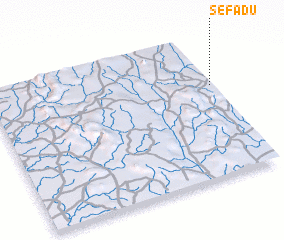 Places with similar names to Sefadu, Sierra Leone ::
Disclaimer :: Information on this page comes without warranty of any kind |
||
|
Where is Sefadu? Elevation and coordinates ::
Latitude (lat): 8°39'0"N Longitude (lon): 11°0'0"W
Elevation (approx.): 382m (map arrows pan, magnifying glasses zoom) |
||
|
Visiting Sefadu? Hotel/Accommodation ::
Book a hotel in Sefadu Travel Guide ::
rental cars ::
car rental offers GPS waypoint ::
download a GPX waypoint (PoI) of Sefadu for your GPS receiver
|
||