|
search place name
|
||
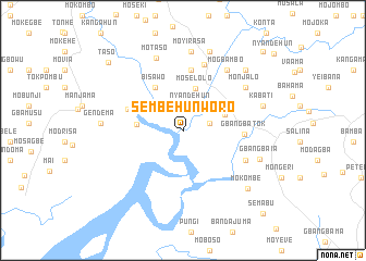
Sembehunworo (Southern, Sierra Leone)Sembehunworo is a town in the Southern region of Sierra Leone. An overview map of the region around Sembehunworo is displayed below.
regional and 3d topo map of Sembehunworo, Sierra Leone ::
Sembehunworo airports ::
The nearest airport is FNA - Freetown Lungi, located 121.9 km north west of Sembehunworo.
Other airports nearby include MLW - Monrovia Spriggs Payne (250.7 km south east), Nearby towns ::
Nyandehun (2.7km north) //
Momengi (2.7km east) //
Mosepi (2.9km north east) //
Moselolo (4.5km north) //
Bengelo (4.5km east) //
Yoke (4.7km west) //
Bisawo (5.2km north west) //
Gerehun (6.0km west) //
Mokango (6.3km north) //
Gbangbatok (6.3km east) //
Balo (7.0km south east) //
Mosenengo (7.1km north) //
Mogbambo (7.7km north east) //
Monjalo (7.7km north east) //
Motaso (7.9km north) //
Moyirasa (8.1km north) //
Gbangbaia (8.4km east) //
Gendema (8.4km west) //
Misila (8.5km north) //
Kabati (8.6km east) //
Kangahun (8.9km north east) //
Mokombe (8.9km south east) //
Taso (10.3km north west) //
Naiaguehun (11.5km north east) //
Semabu (11.9km south east) //
[all distances 'as the bird flies' and approximate] 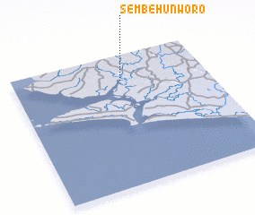 Places with similar names to Sembehunworo, Sierra Leone ::
// Sembehunworo (SL)
Disclaimer :: Information on this page comes without warranty of any kind |
||
|
Where is Sembehunworo? Elevation and coordinates ::
Latitude (lat): 7°48'38"N Longitude (lon): 12°26'27"W
Elevation (approx.): 11m (map arrows pan, magnifying glasses zoom) |
||
|
Visiting Sembehunworo? Hotel/Accommodation ::
Book a hotel in Sembehunworo Travel Guide ::
rental cars ::
car rental offers GPS waypoint ::
download a GPX waypoint (PoI) of Sembehunworo for your GPS receiver
|
||