|
search place name
|
||
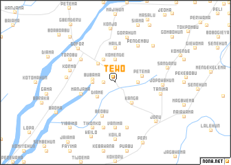
Tewo (Eastern, Sierra Leone)Tewo is a town in the Eastern region of Sierra Leone. An overview map of the region around Tewo is displayed below.
regional and 3d topo map of Tewo, Sierra Leone ::
Tewo airports ::
The nearest airport is MLW - Monrovia Spriggs Payne, located 166.3 km south of Tewo.
Other airports nearby include ROB - Monrovia Roberts Intl (187.3 km south east), Nearby towns ::
Gavuyema (1.8km west) //
Sahun (1.9km north) //
Komende (3.7km north) //
Taninahun (3.7km west) //
Gerehun (3.7km east) //
Diame (3.7km south west) //
Bubama (3.7km west) //
Giema (4.0km north west) //
Jaluahon (4.1km north west) //
Kanga (4.3km south east) //
Petema (4.4km east) //
Haila (5.6km north) //
Manjama (5.8km west) //
Beobu (5.9km south) //
Buguma (6.6km north west) //
Pendembu (7.0km north east) //
Vanima (7.4km south) //
Gorahun (7.5km north) //
Korma (7.6km west) //
Baoma (7.6km south) //
Tanima (7.6km east) //
Boyama (7.6km south) //
Jopowahun (7.6km east) //
Pendabu (7.9km west) //
Gofor (8.2km north west) //
Torobu (8.2km north west) //
Tikonko (8.3km south west) //
Lilema (8.5km north east) //
Konjo (8.7km north) //
[all distances 'as the bird flies' and approximate]  Places with similar names to Tewo, Sierra Leone ::
Disclaimer :: Information on this page comes without warranty of any kind |
||
|
Where is Tewo? Elevation and coordinates ::
Latitude (lat): 7°45'0"N Longitude (lon): 11°7'0"W
Elevation (approx.): 159m (map arrows pan, magnifying glasses zoom) |
||
|
Visiting Tewo? Hotel/Accommodation ::
Book a hotel in Tewo Travel Guide ::
rental cars ::
car rental offers GPS waypoint ::
download a GPX waypoint (PoI) of Tewo for your GPS receiver
|
||