|
search place name
|
||
Wima (Eastern, Sierra Leone)Wima is a town in the Eastern region of Sierra Leone. An overview map of the region around Wima is displayed below.
regional and 3d topo map of Wima, Sierra Leone ::

Wima airports ::
The nearest airport is FAA - Faranah, located 198.1 km north of Wima.
Other airports nearby include FNA - Freetown Lungi (220.7 km west), Nearby towns ::
Taninahun (1.8km west) //
Laimbema (1.9km north) //
Boabu (3.7km west) //
Kenema (3.7km east) //
Teibo (4.1km north west) //
Banda (4.1km south west) //
Kundoma (4.1km north west) //
Yongoima (4.1km south east) //
Woroma (5.6km north) //
Gbeka (5.6km south) //
Pendembu (5.8km east) //
Manjehun (5.8km east) //
Jojoima (5.9km south) //
Masahun (5.9km south) //
Pujehun (6.6km south east) //
Koyama Jego (6.6km south east) //
Mano (6.6km south west) //
Bandajuma (7.3km west) //
Motehun (7.3km east) //
Matama (7.4km north) //
Baoma (7.3km east) //
Bejorma (7.6km west) //
Tangabu (7.6km north) //
Tokpombu (7.8km north east) //
Mano (7.8km south west) //
Bobobu (8.2km north west) //
Sargolehun (8.2km south west) //
Naiawama (8.3km south west) //
Koyama Bulima (8.3km south east) //
[all distances 'as the bird flies' and approximate] 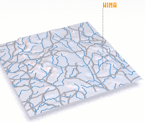 Places with similar names to Wima, Sierra Leone ::
Disclaimer :: Information on this page comes without warranty of any kind |
||
|
Where is Wima? Elevation and coordinates ::
Latitude (lat): 8°18'0"N Longitude (lon): 11°13'0"W
Elevation (approx.): 271m (map arrows pan, magnifying glasses zoom) |
||
|
Visiting Wima? Hotel/Accommodation ::
Book a hotel in Wima Travel Guide ::
rental cars ::
car rental offers GPS waypoint ::
download a GPX waypoint (PoI) of Wima for your GPS receiver
|
||