|
search place name
|
||
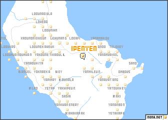
Ipenyen (Tafea, Vanuatu)Ipenyen is a town in the Tafea region of Vanuatu. An overview map of the region around Ipenyen is displayed below.
regional and 3d topo map of Ipenyen, Vanuatu ::
Ipenyen airports ::
The nearest airport is VLI - Port-vila Port Vila Bauerfield, located 230.3 km north west of Ipenyen.
Other airports nearby include MEE - Mare (258.9 km south west), Nearby towns ::
Ikounap (1.9km south) //
Imreang (1.7km east) //
Isaka (2.5km south east) //
Yankoula (2.5km south east) //
Looutopounga (3.7km north) //
Yanmileun (4.1km south east) //
Leumanggoviati (4.1km north west) //
Loéafi (4.1km north west) //
Waésisi (4.1km north east) //
Loouniel (4.1km north east) //
Ilisilis (4.1km north east) //
Loonoo (4.0km north east) //
Loanengo (5.1km south east) //
Imwareupo (5.1km north west) //
Yanamahou (5.1km north east) //
White Sands (5.2km east) //
Yanamwakel (5.2km east) //
Looulooupou (5.6km east) //
Lam̄inaora (5.6km west) //
Lankourou (6.4km south east) //
Lahoénuwi (6.6km north west) //
Lawénata (6.6km north west) //
Ikounala (6.6km south west) //
Yaoukouriruang (6.6km south west) //
Iwey (6.4km south west) //
Yapnawitaleng (6.4km south west) //
Ikouroup (6.6km south east) //
Léhunang (6.4km north west) //
Lénapouas (7.0km west) //
[all distances 'as the bird flies' and approximate] 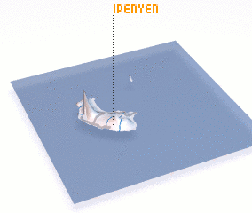 Places with similar names to Ipenyen, Vanuatu :: Disclaimer :: Information on this page comes without warranty of any kind |
||
|
Where is Ipenyen? Elevation and coordinates ::
Latitude (lat): 19°31'0"S Longitude (lon): 169°23'0"E
Elevation (approx.): 397m (map arrows pan, magnifying glasses zoom) |
||
|
Visiting Ipenyen? Hotel/Accommodation ::
Book a hotel in Ipenyen Travel Guide ::
Buy a travel guide for Vanuatu rental cars ::
car rental offers GPS waypoint ::
download a GPX waypoint (PoI) of Ipenyen for your GPS receiver
|
||