|
search place name
|
||
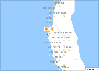
Kéké ((( Pentecôte )), Vanuatu)Kéké is a town in the (( Pentecôte )) region of Vanuatu. An overview map of the region around Kéké is displayed below.
regional and 3d topo map of Kéké, Vanuatu ::
Nearby towns ::
Bwatnapné (0.0km north) //
Limalgan (0.0km north) //
Engem (0.0km north) //
Lélislis (1.9km south) //
Légal (1.9km south) //
Nakonrabonga (1.8km east) //
Towol (1.9km north) //
Lérourouk (1.9km north) //
Lénana (1.9km north) //
Woïnkoni (1.9km north) //
Kamel Léwawa (1.9km north) //
Tosi (2.6km south east) //
Lewaïbilak (2.6km south east) //
Leboung (2.6km south east) //
Koulbaga (2.6km south east) //
Lélvah (3.7km south) //
Wadounbaba (3.7km south) //
Tongwé (3.7km south) //
Varéwérèp (3.7km south) //
Linèn (3.7km south) //
Wanbagam (3.6km east) //
Iliwaba (3.7km north) //
Namaram (3.7km north) //
Wadounbowi (4.1km south east) //
Lératowo (4.1km south east) //
Nokokoul (4.1km south east) //
Léboukouvini (4.1km south east) //
Nokombilatata (4.1km south east) //
Laravinambosvi (4.0km south east) //
[all distances 'as the bird flies' and approximate]  Places with similar names to Kéké, Vanuatu ::
Disclaimer :: Information on this page comes without warranty of any kind |
||
|
Where is Kéké? Elevation and coordinates ::
Latitude (lat): 15°40'0"S Longitude (lon): 168°7'0"E
Elevation (approx.): -32768m (map arrows pan, magnifying glasses zoom) |
||
|
Visiting Kéké? Hotel/Accommodation ::
Book a hotel in Kéké Travel Guide ::
Buy a travel guide for Vanuatu rental cars ::
car rental offers GPS waypoint ::
download a GPX waypoint (PoI) of Kéké for your GPS receiver
|
||