|
search place name
|
||
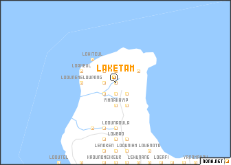
Lakétam (Tafea, Vanuatu)Lakétam is a town in the Tafea region of Vanuatu. An overview map of the region around Lakétam is displayed below.
regional and 3d topo map of Lakétam, Vanuatu ::
Lakétam airports ::
The nearest airport is VLI - Port-vila Port Vila Bauerfield, located 211.6 km north west of Lakétam.
Nearby towns ::
Enouwakeur (0.0km north) //
Laounalang (1.9km south) //
Loounimhapeun (1.9km north) //
Eniou (1.7km west) //
Green Hill (2.5km south west) //
Loélafomwa (2.5km south east) //
Lomwanapiep (2.5km south east) //
Imwafeun (2.5km north west) //
Loounatkey (3.7km south) //
Yimnakayip (3.7km south) //
Loonélangat (4.0km north east) //
Lotapouna (4.1km south east) //
Lowiteul (5.1km north west) //
Loounémeloupang (5.2km west) //
Loameul (5.6km west) //
Lenaükas (7.4km south) //
Loounaoula (7.4km south) //
Laroup (7.4km south) //
Iléreup (7.6km south) //
Looukeureus (8.2km south west) //
[all distances 'as the bird flies' and approximate] 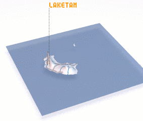 Places with similar names to Lakétam, Vanuatu ::
Disclaimer :: Information on this page comes without warranty of any kind |
||
|
Where is Lakétam? Elevation and coordinates ::
Latitude (lat): 19°22'0"S Longitude (lon): 169°18'0"E
Elevation (approx.): 305m (map arrows pan, magnifying glasses zoom) |
||
|
Visiting Lakétam? Hotel/Accommodation ::
Book a hotel in Lakétam Travel Guide ::
Buy a travel guide for Vanuatu rental cars ::
car rental offers GPS waypoint ::
download a GPX waypoint (PoI) of Lakétam for your GPS receiver
|
||