|
search place name
|
||
Chalilo (Malawi)Chalilo is a town in Malawi. An overview map of the region around Chalilo is displayed below.
regional and 3d topo map of Chalilo, Malawi ::

Chalilo airports ::
The nearest airport is LLW - Lilongwe Kamuzu Intl, located 37.7 km north west of Chalilo.
Other airports nearby include VXC - Lichinga (164.2 km north east), BLZ - Blantyre Chileka Intl (207.8 km south east), Nearby towns ::
Chiwosa (0.0km north) //
Chilima (0.0km north) //
Kurdzi (0.0km north) //
Mazengera (1.8km west) //
Chilimangʼombe (2.6km north west) //
Dzuwo (4.1km south west) //
Kamphiningo (4.1km south east) //
Kampata (4.1km south east) //
Chinguwo (4.0km south east) //
Malaza (5.2km south east) //
Maiwa (5.6km south) //
Phambala (5.8km south) //
Matapela (5.8km north) //
Danda (6.6km south west) //
Sonkhwe (6.5km south west) //
Nthesa (6.6km south east) //
Gunde (7.6km south) //
Kalumbu (8.2km south west) //
Msendere (8.2km south east) //
Cibwata (9.1km south east) //
Nokomde (10.3km south west) //
Mgwena (10.3km south west) //
[all distances 'as the bird flies' and approximate] 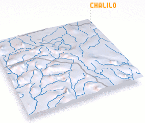 Places with similar names to Chalilo, Malawi ::
// Shiloh Hill (US)
// Šiauleliai (LT)
// Chiliile (RO)
// Chiliile (RO)
// Chulilla (ES)
// Chalālī (IR)
// Chālelū (IR)
// Chāl Ghelāgh (IR)
// Chūlalū (IR)
// Chilili (US)
Disclaimer :: Information on this page comes without warranty of any kind |
||
|
Where is Chalilo? Elevation and coordinates ::
Latitude (lat): 14°4'0"S Longitude (lon): 33°59'0"E
Elevation (approx.): 1139m (map arrows pan, magnifying glasses zoom) |
||
|
Visiting Chalilo? Hotel/Accommodation ::
Book a hotel in Chalilo Travel Guide ::
Buy a travel guide for Malawi rental cars ::
car rental offers GPS waypoint ::
download a GPX waypoint (PoI) of Chalilo for your GPS receiver
|
||