|
search place name
|
||
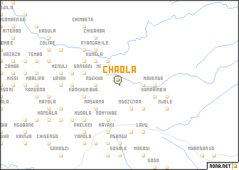
Chaola (Malawi)Chaola is a town in Malawi. An overview map of the region around Chaola is displayed below.
regional and 3d topo map of Chaola, Malawi ::
Chaola airports ::
The nearest airport is LLW - Lilongwe Kamuzu Intl, located 34.5 km south west of Chaola.
Other airports nearby include VXC - Lichinga (136.4 km east), Nearby towns ::
Mpozera (2.6km north west) //
Kandzu (2.6km north west) //
Mawende (3.6km east) //
Ndekwa (3.6km west) //
Nasungwi (4.1km south east) //
Namoni (4.1km south east) //
Ndozizira (4.1km south east) //
Chipapi (4.1km north west) //
Kodikila (5.2km south east) //
Kamagwahkwa (5.2km south east) //
Chimpala (5.2km south west) //
Maswana (5.2km south west) //
Kumela (5.2km north west) //
Mawende (5.4km east) //
Sansani (5.7km west) //
Chatambalala (5.7km west) //
Kankhumbwa (5.7km west) //
Nomyimbe (5.8km south) //
Kamphimba (5.7km east) //
Jemus (6.6km north west) //
Jonas (6.6km north west) //
Nyangamile (6.6km north west) //
Chamkoma (7.2km west) //
Chidothi (7.4km east) //
Kwis (7.6km south) //
Chiponda (7.6km south) //
Bimpi (7.4km west) //
Mayani (7.6km south) //
Mdoala (7.8km south west) //
[all distances 'as the bird flies' and approximate] 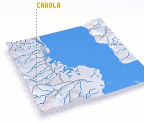 Places with similar names to Chaola, Malawi ::
Disclaimer :: Information on this page comes without warranty of any kind |
||
|
Where is Chaola? Elevation and coordinates ::
Latitude (lat): 13°39'0"S Longitude (lon): 34°4'0"E
Elevation (approx.): 1025m (map arrows pan, magnifying glasses zoom) |
||
|
Visiting Chaola? Hotel/Accommodation ::
Book a hotel in Chaola Travel Guide ::
Buy a travel guide for Malawi rental cars ::
car rental offers GPS waypoint ::
download a GPX waypoint (PoI) of Chaola for your GPS receiver
|
||