|
search place name
|
||
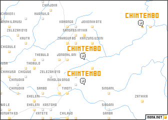
Chimtembo (Malawi)Chimtembo is a town in Malawi. An overview map of the region around Chimtembo is displayed below.
regional and 3d topo map of Chimtembo, Malawi ::
Chimtembo airports ::
The nearest airport is ZZU - Mzuzu, located 93.6 km north of Chimtembo.
Other airports nearby include LLW - Lilongwe Kamuzu Intl (172.4 km south), VXC - Lichinga (205.4 km south east), MFU - Mfuwe (222.6 km south west), Nearby towns ::
Nchapito (1.9km north) //
Gundasiche Nyambwane (1.9km north) //
Makawila (2.6km south east) //
Jona Nhlani (3.6km west) //
Kamzunguzeni (4.1km north east) //
Makawira Chirwa (4.1km north west) //
Jonashani (4.1km south west) //
Zawa Gumbo (5.2km north west) //
Donija Nkhoma (5.6km north) //
Chimtembo (5.6km south) //
Kathundu (5.4km west) //
Jonashani (5.8km south) //
Sandresi Nyika (5.8km north) //
Jeke Nkhate (7.6km north) //
Chibwana (7.6km north) //
Germani Nthala (7.6km north) //
Nkholowondo (7.8km south west) //
Kamanga (8.3km north west) //
Timoti (8.3km south west) //
Zeleza Moyo (8.1km south west) //
Sindani (9.2km south east) //
Timoti (9.2km south west) //
[all distances 'as the bird flies' and approximate] 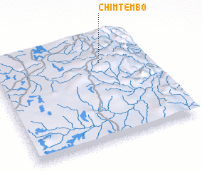 Places with similar names to Chimtembo, Malawi ::
// Shamaidām (MM)
// Siamutombo (ZM)
// Siamutumbu (ZM)
// Shimtami (NG)
// Chimtembo (MW)
// Chimtembo (MW)
Disclaimer :: Information on this page comes without warranty of any kind |
||
|
Where is Chimtembo? Elevation and coordinates ::
Latitude (lat): 12°14'0"S Longitude (lon): 33°42'0"E
Elevation (approx.): 1452m (map arrows pan, magnifying glasses zoom) |
||
|
Visiting Chimtembo? Hotel/Accommodation ::
Book a hotel in Chimtembo Travel Guide ::
Buy a travel guide for Malawi rental cars ::
car rental offers GPS waypoint ::
download a GPX waypoint (PoI) of Chimtembo for your GPS receiver
|
||