|
search place name
|
||
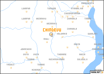
Chindevu (Malawi)Chindevu is a town in Malawi. An overview map of the region around Chindevu is displayed below.
regional and 3d topo map of Chindevu, Malawi ::
Chindevu airports ::
The nearest airport is ZZU - Mzuzu, located 18.2 km north of Chindevu.
Other airports nearby include KGJ - Karonga (183.1 km north), VXC - Lichinga (226.5 km south east), Nearby towns ::
Nkuli (2.6km south west) //
Wazankhu (3.7km north) //
Kalumpha (3.6km east) //
Chinyakula (6.6km south east) //
Wazankhu (6.6km north west) //
Chipwaila (7.5km east) //
Chamawoya (8.3km north east) //
Tihomane (8.3km south east) //
Chipwaila (9.1km north east) //
Dewe (9.1km north west) //
Vivya (9.2km south west) //
Chijere (9.2km north east) //
Chikondawanga (10.4km north east) //
[all distances 'as the bird flies' and approximate] 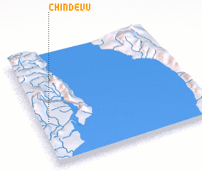 Places with similar names to Chindevu, Malawi ::
// Chenatfa (MA)
// Tiantéfa (BJ)
// Shandavu (ZM)
// Chīndagh (PK)
// Chondugh (NG)
// Shindifu (NG)
// Chʼendefo (ET)
// Shenatʼagh (AM)
// Shandaghah (AE)
Disclaimer :: Information on this page comes without warranty of any kind |
||
|
Where is Chindevu? Elevation and coordinates ::
Latitude (lat): 11°36'0"S Longitude (lon): 34°4'0"E
Elevation (approx.): 678m (map arrows pan, magnifying glasses zoom) |
||
|
Visiting Chindevu? Hotel/Accommodation ::
Book a hotel in Chindevu Travel Guide ::
Buy a travel guide for Malawi rental cars ::
car rental offers GPS waypoint ::
download a GPX waypoint (PoI) of Chindevu for your GPS receiver
|
||