|
search place name
|
||
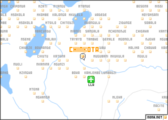
Chinkota (Malawi)Chinkota is a town in Malawi. An overview map of the region around Chinkota is displayed below.
regional and 3d topo map of Chinkota, Malawi ::
Chinkota airports ::
The nearest airport is LLW - Lilongwe Kamuzu Intl, located 4.6 km south of Chinkota.
Other airports nearby include VXC - Lichinga (170.7 km east), MFU - Mfuwe (205.4 km west), BLZ - Blantyre Chileka Intl (249.9 km south east), Nearby towns ::
Cimkonbera (1.8km east) //
Dothi (1.9km south) //
Manondo (1.9km north) //
Mugubani (3.6km east) //
Miange (3.7km north) //
Chitukula (3.7km south) //
Chikonde (3.6km west) //
Tambwe (4.1km north east) //
Kamlembo (4.1km south east) //
Kachuli (4.0km north east) //
Mkubu (4.0km north east) //
Tayayo (4.1km north west) //
Bowa (4.1km south west) //
Chokolokotha (4.0km south west) //
Chikhadwe (5.4km east) //
Gulundu (5.6km north) //
Chilando (5.6km north) //
Katera (5.4km west) //
Ciseko (5.4km west) //
Sangala (5.8km north) //
Makwasi (5.7km east) //
Kundwe (5.7km east) //
Makondesa (5.8km north) //
Miange (5.8km north) //
Kazembe (5.8km north) //
Mgunzi (5.7km west) //
Derale (6.6km north east) //
Lumbadzi (6.5km south east) //
Msilisa (6.6km north east) //
[all distances 'as the bird flies' and approximate] 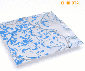 Places with similar names to Chinkota, Malawi ::
// Shangtai (MM)
// Tiang Dua (MY)
// Chancuda (PT)
// Chiang Dao (TH)
// Chineket (RU)
// Chengti (BD)
// Chinácota (CO)
// Changoti (IN)
// Shencottah (IN)
// Shingāit (IN)
Disclaimer :: Information on this page comes without warranty of any kind |
||
|
Where is Chinkota? Elevation and coordinates ::
Latitude (lat): 13°45'0"S Longitude (lon): 33°46'0"E
Elevation (approx.): 1243m (map arrows pan, magnifying glasses zoom) |
||
|
Visiting Chinkota? Hotel/Accommodation ::
Book a hotel in Chinkota Travel Guide ::
Buy a travel guide for Malawi rental cars ::
car rental offers GPS waypoint ::
download a GPX waypoint (PoI) of Chinkota for your GPS receiver
|
||