|
search place name
|
||
Gobedi (Malawi)Gobedi is a town in Malawi. An overview map of the region around Gobedi is displayed below.
regional and 3d topo map of Gobedi, Malawi ::

Gobedi airports ::
The nearest airport is LLW - Lilongwe Kamuzu Intl, located 55.5 km south east of Gobedi.
Other airports nearby include MFU - Mfuwe (173.3 km west), VXC - Lichinga (187.9 km east), ZZU - Mzuzu (217.1 km north), Nearby towns ::
Jim (2.6km north west) //
Nkungulu (2.6km north east) //
Chapuwala (4.1km north east) //
Nambela (4.1km north west) //
Mkwinya (4.1km north west) //
Chakhala (5.2km north west) //
Chinkwangula (5.2km south east) //
Katalima (5.4km east) //
Chungu (5.8km north) //
Njombwa (5.8km north) //
Katalima (5.7km east) //
Chimamba (5.7km east) //
Chaima (6.6km north west) //
Chatalala (6.6km north west) //
Milimbu (6.6km south east) //
Kalonga (7.2km west) //
Chilemba (7.2km east) //
Chitseko (7.4km north) //
Makombwa (7.4km west) //
Chilinkoli (7.4km west) //
Chiseko (7.6km north) //
Chika (7.6km north) //
Namkumba (7.4km east) //
Katayene (7.4km east) //
Mpamba (7.4km east) //
Kamphata (7.6km south) //
Chimwendo (7.6km south) //
Chimwara (7.8km north west) //
Chilanga (8.2km north west) //
[all distances 'as the bird flies' and approximate] 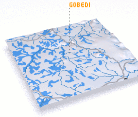 Places with similar names to Gobedi, Malawi ::
Disclaimer :: Information on this page comes without warranty of any kind |
||
|
Where is Gobedi? Elevation and coordinates ::
Latitude (lat): 13°21'0"S Longitude (lon): 33°32'0"E
Elevation (approx.): 1072m (map arrows pan, magnifying glasses zoom) |
||
|
Visiting Gobedi? Hotel/Accommodation ::
Book a hotel in Gobedi Travel Guide ::
Buy a travel guide for Malawi rental cars ::
car rental offers GPS waypoint ::
download a GPX waypoint (PoI) of Gobedi for your GPS receiver
|
||