|
search place name
|
||
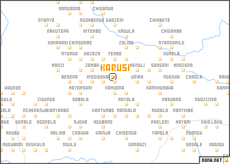
Karusi (Malawi)Karusi is a town in Malawi. An overview map of the region around Karusi is displayed below.
regional and 3d topo map of Karusi, Malawi ::
Karusi airports ::
The nearest airport is LLW - Lilongwe Kamuzu Intl, located 23.9 km south west of Karusi.
Other airports nearby include VXC - Lichinga (148.5 km east), Nearby towns ::
Mbalira (NaNkm north) //
Kalindangoma (1.9km north) //
Kamuona (1.9km south) //
Dowa (1.8km west) //
Chindura (1.8km west) //
Cikho (2.6km south east) //
Moya (2.6km north west) //
Uriah (3.6km east) //
Chakuma (3.6km east) //
Tembo (3.7km north) //
Katema (3.6km west) //
Missi (3.6km west) //
Menuli (4.1km north east) //
Kamuona (4.1km south east) //
Mayola (4.1km south east) //
Gomba (4.1km south east) //
Mazyake (4.1km north east) //
Shani (4.1km north west) //
Msoci (4.1km north west) //
Zamba (4.1km north west) //
Mkanthama (4.1km north west) //
Dowa (5.2km south east) //
Lichapa (5.2km south east) //
Wazaza (5.2km north west) //
Chamkoma (5.4km east) //
Kapondasoka (5.6km south) //
Kasagula (5.4km west) //
Chinkhota (5.4km west) //
Mandala (5.8km south) //
[all distances 'as the bird flies' and approximate]  Places with similar names to Karusi, Malawi ::
Disclaimer :: Information on this page comes without warranty of any kind |
||
|
Where is Karusi? Elevation and coordinates ::
Latitude (lat): 13°39'0"S Longitude (lon): 33°57'0"E
Elevation (approx.): 1337m (map arrows pan, magnifying glasses zoom) |
||
|
Visiting Karusi? Hotel/Accommodation ::
Book a hotel in Karusi Travel Guide ::
Buy a travel guide for Malawi rental cars ::
car rental offers GPS waypoint ::
download a GPX waypoint (PoI) of Karusi for your GPS receiver
|
||