|
search place name
|
||
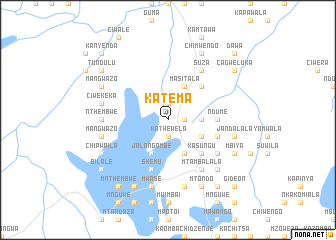
Katema (Malawi)Katema is a town in Malawi. An overview map of the region around Katema is displayed below.
regional and 3d topo map of Katema, Malawi ::
Katema airports ::
The nearest airport is LLW - Lilongwe Kamuzu Intl, located 94.4 km south of Katema.
Other airports nearby include MFU - Mfuwe (166.6 km west), ZZU - Mzuzu (182.6 km north), VXC - Lichinga (199.2 km east), Nearby towns ::
Msolola (1.8km east) //
Chibisa (1.9km north) //
Kathewela (1.9km south) //
Ndume (3.6km east) //
Kasalika (4.1km south east) //
Kanchembele (4.1km south east) //
Juma (4.1km south east) //
Masitala (4.1km north east) //
Jalangombe (4.1km south west) //
Kasungu (5.2km south east) //
Cisazima (5.2km north east) //
Ndume (5.4km east) //
Chilanga (5.7km east) //
Shemu (5.8km south) //
Suza (6.6km north east) //
Mtambalala (6.6km south east) //
Kasalika (6.6km south east) //
Kasanka (6.6km south east) //
Gaga (7.2km west) //
Nthembwe (7.2km west) //
Jandalala (7.5km east) //
Matako (7.6km south) //
Chinyamunyamu (7.6km south) //
Mwase (7.6km south) //
Ciwekeka (7.5km west) //
Mangwazo (7.5km west) //
Chiteyeye (7.8km south east) //
Gundani (7.8km south east) //
Mtondo (8.2km south east) //
[all distances 'as the bird flies' and approximate] 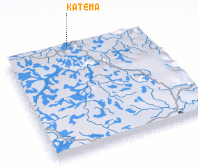 Places with similar names to Katema, Malawi ::
Disclaimer :: Information on this page comes without warranty of any kind |
||
|
Where is Katema? Elevation and coordinates ::
Latitude (lat): 13°0'0"S Longitude (lon): 33°27'0"E
Elevation (approx.): 1050m (map arrows pan, magnifying glasses zoom) |
||
|
Visiting Katema? Hotel/Accommodation ::
Book a hotel in Katema Travel Guide ::
Buy a travel guide for Malawi rental cars ::
car rental offers GPS waypoint ::
download a GPX waypoint (PoI) of Katema for your GPS receiver
|
||