|
search place name
|
||
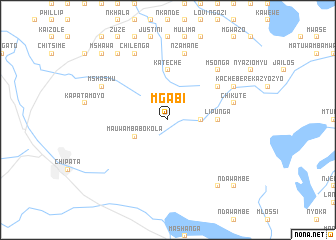
Mgabi (Malawi)Mgabi is a town in Malawi. An overview map of the region around Mgabi is displayed below.
regional and 3d topo map of Mgabi, Malawi ::
Mgabi airports ::
The nearest airport is MFU - Mfuwe, located 95.1 km west of Mgabi.
Other airports nearby include LLW - Lilongwe Kamuzu Intl (113.8 km east), Nearby towns ::
Kapunula (3.6km east) //
Mauwamba Bokola (4.1km south west) //
Kapezi (4.1km south west) //
Lipunga (5.4km east) //
Kateche (5.6km north) //
Msonga (6.6km north east) //
Chafomera (7.6km north) //
Manando (7.6km north) //
Nzamane (7.6km north) //
Chikute (7.4km east) //
Msonga (7.8km north east) //
Chilenga (8.2km north west) //
Mshashu (8.1km north west) //
Kachebere (8.1km north east) //
Kwanja (9.2km north west) //
Chongololo (9.2km north west) //
Magwero (9.2km south east) //
Mshawa (10.3km north west) //
Ndawambe (10.3km south east) //
[all distances 'as the bird flies' and approximate] 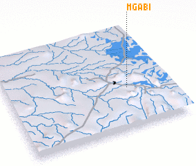 Places with similar names to Mgabi, Malawi ::
Disclaimer :: Information on this page comes without warranty of any kind |
||
|
Where is Mgabi? Elevation and coordinates ::
Latitude (lat): 13°35'0"S Longitude (lon): 32°45'0"E
Elevation (approx.): 1299m (map arrows pan, magnifying glasses zoom) |
||
|
Visiting Mgabi? Hotel/Accommodation ::
Book a hotel in Mgabi Travel Guide ::
Buy a travel guide for Malawi rental cars ::
car rental offers GPS waypoint ::
download a GPX waypoint (PoI) of Mgabi for your GPS receiver
|
||