|
search place name
|
||
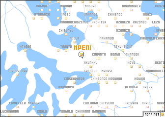
Mpeni (Malawi)Mpeni is a town in Malawi. An overview map of the region around Mpeni is displayed below.
regional and 3d topo map of Mpeni, Malawi ::
Mpeni airports ::
The nearest airport is LLW - Lilongwe Kamuzu Intl, located 74.4 km south east of Mpeni.
Other airports nearby include MFU - Mfuwe (167.9 km west), VXC - Lichinga (193.5 km east), ZZU - Mzuzu (200.7 km north), Nearby towns ::
Chiphapi (2.6km south east) //
Mkunkhu (2.6km south east) //
Chivimya (3.6km east) //
Yesaya (4.1km north west) //
Tena (4.1km north west) //
Mvula (4.1km north west) //
Gwesele (4.1km south east) //
Chiphapi (5.2km south east) //
Chinkhoma (5.2km south east) //
Mphungu (5.7km west) //
Msenga (5.7km west) //
Chisemphere (5.8km south) //
Chibunyu (6.6km north west) //
Mawango I (6.6km north east) //
John (6.6km north east) //
Chimbonga (6.6km south east) //
Mphasi (6.6km south east) //
Chipokolo (6.6km south east) //
Bondo (7.2km east) //
Amos Zakocera (7.6km north) //
Chipekwe (7.6km north) //
Chinduwe (7.6km north) //
Kaombachidzenje (7.6km north) //
Bwanali (7.6km north) //
Kanyundo (7.8km south east) //
Kachitsa (8.2km north east) //
Kamphuru (8.2km south west) //
Kachelenga (8.1km north east) //
Chiwengo (9.2km north east) //
[all distances 'as the bird flies' and approximate]  Places with similar names to Mpeni, Malawi ::
Disclaimer :: Information on this page comes without warranty of any kind |
||
|
Where is Mpeni? Elevation and coordinates ::
Latitude (lat): 13°11'0"S Longitude (lon): 33°29'0"E
Elevation (approx.): 1083m (map arrows pan, magnifying glasses zoom) |
||
|
Visiting Mpeni? Hotel/Accommodation ::
Book a hotel in Mpeni Travel Guide ::
Buy a travel guide for Malawi rental cars ::
car rental offers GPS waypoint ::
download a GPX waypoint (PoI) of Mpeni for your GPS receiver
|
||