|
search place name
|
||
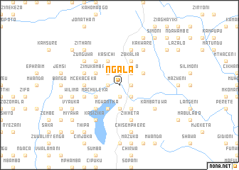
Ngala (Malawi)Ngala is a town in Malawi. An overview map of the region around Ngala is displayed below.
regional and 3d topo map of Ngala, Malawi ::
Ngala airports ::
The nearest airport is ZZU - Mzuzu, located 134.4 km north east of Ngala.
Other airports nearby include LLW - Lilongwe Kamuzu Intl (140.5 km south), MFU - Mfuwe (186.9 km south west), VXC - Lichinga (207.7 km south east), Nearby towns ::
Kajosi (1.9km south) //
Cikoya (1.9km north) //
Mukula (1.8km east) //
Mzungunika (1.8km west) //
Cakuzizwa (1.8km east) //
Mozesi (2.6km south east) //
Wanthewa (2.6km south east) //
Tamleti (2.6km north west) //
Kalikoka (2.6km north east) //
Nyangula (2.6km south east) //
Kapandula (2.6km north west) //
Nganjo (2.6km north east) //
Kelula (3.7km south) //
Kamzimbi (3.7km south) //
Kaluluma (4.1km south east) //
Citoneka (4.1km south west) //
Mgwantha (4.1km south west) //
Kasichi (4.1km north west) //
Zakalia (4.1km north east) //
Ciwela (4.1km south west) //
Zimukambani (4.1km north west) //
Cibojora (4.1km north east) //
Machuleka (4.1km south west) //
Cimtake (5.2km south west) //
Kamdidi (5.2km north west) //
Mcekaceka (5.4km west) //
Sitolo (5.7km west) //
Kajwanthira (5.7km west) //
Alamu (5.7km west) //
[all distances 'as the bird flies' and approximate]  Places with similar names to Ngala, Malawi ::
Disclaimer :: Information on this page comes without warranty of any kind |
||
|
Where is Ngala? Elevation and coordinates ::
Latitude (lat): 12°33'0"S Longitude (lon): 33°30'0"E
Elevation (approx.): 1192m (map arrows pan, magnifying glasses zoom) |
||
|
Visiting Ngala? Hotel/Accommodation ::
Book a hotel in Ngala Travel Guide ::
Buy a travel guide for Malawi rental cars ::
car rental offers GPS waypoint ::
download a GPX waypoint (PoI) of Ngala for your GPS receiver
|
||