|
search place name
|
||
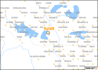
Njiwa (Malawi)Njiwa is a town in Malawi. An overview map of the region around Njiwa is displayed below.
regional and 3d topo map of Njiwa, Malawi ::
Njiwa airports ::
The nearest airport is LLW - Lilongwe Kamuzu Intl, located 54.6 km north east of Njiwa.
Other airports nearby include MFU - Mfuwe (169.5 km north west), VXC - Lichinga (225.1 km east), BLZ - Blantyre Chileka Intl (258.9 km south east), Nearby towns ::
Cigunda (1.9km south) //
Sinumbe (2.6km north west) //
Kansukwa (2.6km south west) //
Kapuzama (3.7km north) //
Msangwa (4.0km north east) //
Nkhono (4.1km north west) //
Kadzombe (4.1km south east) //
Nkhonka (4.1km south east) //
Sinombe (4.1km south west) //
Namitete (5.2km south east) //
Kachigulu (5.4km west) //
Namazani (5.4km west) //
Mlonyeni (5.4km west) //
Chadzuka (5.6km south) //
Manyon (5.7km west) //
Kankhande (5.7km west) //
Sadvala (5.8km north) //
Mchipira (5.8km south) //
Chisikwa II (5.7km east) //
Kadzani (5.8km north) //
Mpandula (6.6km south east) //
Chimono (6.6km north east) //
Fisi (6.6km north east) //
Chikuzulira (6.5km north east) //
Mbwelele (6.6km north west) //
Kamangira (7.2km east) //
Sankulani (7.4km north) //
Njati (7.2km west) //
Kadzombe (7.4km south) //
[all distances 'as the bird flies' and approximate]  Places with similar names to Njiwa, Malawi ::
Disclaimer :: Information on this page comes without warranty of any kind |
||
|
Where is Njiwa? Elevation and coordinates ::
Latitude (lat): 13°59'0"S Longitude (lon): 33°19'0"E
Elevation (approx.): 1134m (map arrows pan, magnifying glasses zoom) |
||
|
Visiting Njiwa? Hotel/Accommodation ::
Book a hotel in Njiwa Travel Guide ::
Buy a travel guide for Malawi rental cars ::
car rental offers GPS waypoint ::
download a GPX waypoint (PoI) of Njiwa for your GPS receiver
|
||