|
search place name
|
||
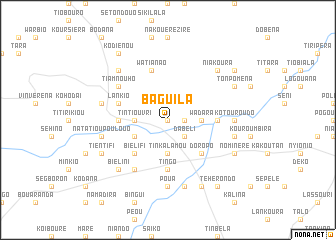
Baguila (Cote d'Ivoire)Baguila is a town in Cote d'Ivoire. An overview map of the region around Baguila is displayed below.
regional and 3d topo map of Baguila, Cote d'Ivoire ::
Baguila airports ::
The nearest airport is BOY - Bobo-dioulasso Bobo Dioulasso, located 179.3 km north west of Baguila.
Nearby towns ::
Niona (0.0km north) //
Baria (1.8km east) //
Dabéli (2.6km south east) //
Koumala (3.7km south) //
Tinkalamou (3.7km south) //
Nakélé (3.7km west) //
Tintiouvri (3.7km west) //
Wadara (3.7km east) //
Binazi (4.1km south west) //
Biélifi (5.2km south west) //
Bérikiri (5.2km south east) //
Doropo (5.2km south east) //
Tingo (5.6km south) //
Kivaï (5.5km west) //
Baltan (5.5km west) //
Kiripi (5.5km east) //
Watianao (5.9km north) //
Lankio (5.8km west) //
Yalo (6.7km south west) //
Tiamnouho (6.6km north west) //
Poua (7.4km south) //
Kotouroudo (7.3km east) //
Béïriéra (7.5km west) //
Natatioupoulouo (7.5km west) //
Sourouboura (7.6km south) //
Biékiri (7.5km east) //
Biélini (7.8km south west) //
Tioboulonao (7.8km north west) //
Niakoura (7.8km north east) //
[all distances 'as the bird flies' and approximate] 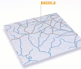 Places with similar names to Baguila, Cote d'Ivoire ::
Disclaimer :: Information on this page comes without warranty of any kind |
||
|
Where is Baguila? Elevation and coordinates ::
Latitude (lat): 9°51'0"N Longitude (lon): 3°22'0"W
Elevation (approx.): 307m (map arrows pan, magnifying glasses zoom) |
||
|
Visiting Baguila? Hotel/Accommodation ::
Book a hotel in Baguila Travel Guide ::
rental cars ::
car rental offers GPS waypoint ::
download a GPX waypoint (PoI) of Baguila for your GPS receiver
|
||