|
search place name
|
||
Katiné-Konankro (Cote d'Ivoire)Katiné-Konankro is a town in Cote d'Ivoire. An overview map of the region around Katiné-Konankro is displayed below.
regional and 3d topo map of Katiné-Konankro, Cote d'Ivoire ::

Katiné-Konankro airports ::
The nearest airport is BYK - Bouake, located 121.0 km north west of Katiné-Konankro.
Other airports nearby include ASK - Yamoussoukro (123.9 km west), ABJ - Abidjan Felix Houphouet Boigny Intl (197.4 km south), NYI - Sunyani (215.6 km east), Nearby towns ::
Akafou-Nzikro (0.0km north) //
Aboukro (1.8km east) //
Nguissankro (1.8km east) //
Kongromati (1.8km east) //
Pakoukouana (2.6km south west) //
Abéanou (5.1km south) //
Kouakoukona (5.9km north) //
Aboukro (5.9km north) //
Brounguessa (5.9km north) //
Yafi-Kouamékro (6.6km north west) //
Zékrézinssou (7.0km north west) //
Akongba (7.6km north) //
Kouatanou Namivenou (7.6km west) //
Kouakouna (7.7km north east) //
Youssouf Kamara (7.8km north east) //
Attanou (8.0km south west) //
Bananguézansou (8.0km west) //
Katièplénou (8.6km north west) //
Proukro (8.7km south west) //
Srakakro (9.2km north east) //
Kouassi Nzikro (10.3km south west) //
[all distances 'as the bird flies' and approximate] 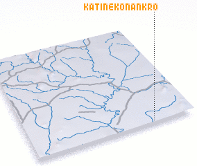 Places with similar names to Katiné-Konankro, Cote d'Ivoire :: Disclaimer :: Information on this page comes without warranty of any kind |
||
|
Where is Katiné-Konankro? Elevation and coordinates ::
Latitude (lat): 7°1'0"N Longitude (lon): 4°15'0"W
Elevation (approx.): 133m (map arrows pan, magnifying glasses zoom) |
||
|
Visiting Katiné-Konankro? Hotel/Accommodation ::
Book a hotel in Katiné-Konankro Travel Guide ::
rental cars ::
car rental offers GPS waypoint ::
download a GPX waypoint (PoI) of Katiné-Konankro for your GPS receiver
|
||