|
search place name
|
||
Koubi (Cote d'Ivoire)Koubi is a town in Cote d'Ivoire. An overview map of the region around Koubi is displayed below.
regional and 3d topo map of Koubi, Cote d'Ivoire ::

Koubi airports ::
The nearest airport is ASK - Yamoussoukro, located 33.2 km south east of Koubi.
Other airports nearby include DJO - Daloa (96.1 km west), BYK - Bouake (99.9 km north east), MJC - Man (217.0 km west), ABJ - Abidjan Felix Houphouet Boigny Intl (272.4 km south east), Nearby towns ::
Diali (2.4km north east) //
Ndénou (2.7km south) //
Ouanzanou (3.8km south) //
Kami (3.8km south east) //
Akoundoukro (5.3km west) //
Tikekro (5.4km south east) //
Tokorossou (5.5km west) //
Degbézéré (5.6km south) //
Pakoki (5.8km south east) //
Begbessou (6.0km north east) //
Tangouobouita (6.8km south east) //
Bokassou (6.9km south east) //
Dotazia (7.6km south) //
Nda-Kofi-Yobouékro (8.0km east) //
Zegatta (9.4km south east) //
Tuyénakro (9.5km south east) //
Koblata (10.3km south west) //
Peya (10.6km south east) //
Kouritadou (10.6km south east) //
Kouassizia (10.6km south east) //
[all distances 'as the bird flies' and approximate] 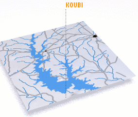 Places with similar names to Koubi, Cote d'Ivoire ::
Disclaimer :: Information on this page comes without warranty of any kind |
||
|
Where is Koubi? Elevation and coordinates ::
Latitude (lat): 7°1'54"N Longitude (lon): 5°38'14"W
Elevation (approx.): 239m (map arrows pan, magnifying glasses zoom) |
||
|
Visiting Koubi? Hotel/Accommodation ::
Book a hotel in Koubi Travel Guide ::
rental cars ::
car rental offers GPS waypoint ::
download a GPX waypoint (PoI) of Koubi for your GPS receiver
|
||