|
search place name
|
||
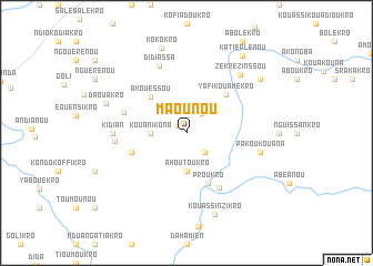
Maounou (Cote d'Ivoire)Maounou is a town in Cote d'Ivoire. An overview map of the region around Maounou is displayed below.
regional and 3d topo map of Maounou, Cote d'Ivoire ::
Maounou airports ::
The nearest airport is BYK - Bouake, located 114.2 km north west of Maounou.
Other airports nearby include ASK - Yamoussoukro (114.7 km west), ABJ - Abidjan Felix Houphouet Boigny Intl (199.4 km south), Nearby towns ::
Konanlékro (1.1km north west) //
Bananguézansou (2.5km north east) //
Kouatanou Namivenou (2.7km south east) //
Kouanikona (3.6km west) //
Ahoutoukro (3.8km south) //
Akouessou (5.1km north west) //
Proukro (5.5km south east) //
Yafi-Kouamékro (5.5km north east) //
Koliakro (5.8km west) //
Attanou (6.4km south east) //
Kolien-Nzikro (6.6km west) //
Diakanga (7.2km west) //
Didiassa (7.3km north) //
Kidian (7.3km west) //
Pakoukouana (7.6km east) //
Zékrézinssou (7.9km north east) //
Daouakro (8.6km west) //
Kouassi Nzikro (8.7km south) //
Kokokro (8.9km north) //
Brounguessa (9.2km north east) //
Katièplénou (9.5km north east) //
[all distances 'as the bird flies' and approximate] 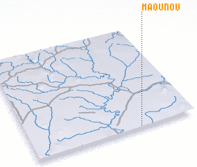 Places with similar names to Maounou, Cote d'Ivoire ::
Disclaimer :: Information on this page comes without warranty of any kind |
||
|
Where is Maounou? Elevation and coordinates ::
Latitude (lat): 7°1'3"N Longitude (lon): 4°20'1"W
Elevation (approx.): 158m (map arrows pan, magnifying glasses zoom) |
||
|
Visiting Maounou? Hotel/Accommodation ::
Book a hotel in Maounou Travel Guide ::
rental cars ::
car rental offers GPS waypoint ::
download a GPX waypoint (PoI) of Maounou for your GPS receiver
|
||