|
search place name
|
||
Ndénoukro (Cote d'Ivoire)Ndénoukro is a town in Cote d'Ivoire. An overview map of the region around Ndénoukro is displayed below.
regional and 3d topo map of Ndénoukro, Cote d'Ivoire ::

Ndénoukro airports ::
The nearest airport is ASK - Yamoussoukro, located 66.1 km south east of Ndénoukro.
Other airports nearby include BYK - Bouake (90.6 km north east), DJO - Daloa (96.5 km south west), MJC - Man (199.2 km west), Nearby towns ::
Diamanbo (4.4km north east) //
Diakohou (5.5km north) //
Ndoufoukankro (6.2km east) //
Aalé (6.8km north east) //
Bouafla II (7.3km south west) //
Nianda (7.6km north) //
Térénou (7.8km east) //
Akotiakro (8.0km north east) //
Blé (8.3km north east) //
Atassé (9.9km north east) //
Maminigui (10.0km north west) //
[all distances 'as the bird flies' and approximate] 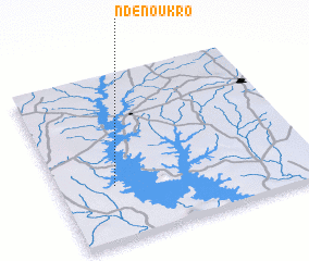 Places with similar names to Ndénoukro, Cote d'Ivoire ::
// Naydongri (IN)
// Neyyāttinkara (IN)
// Ntankro (GH)
// Ntinkra (GH)
// Ndangar (SN)
// Ndinkoro (ML)
// Newtown Gore (IE)
// Noite Negra (BR)
Disclaimer :: Information on this page comes without warranty of any kind |
||
|
Where is Ndénoukro? Elevation and coordinates ::
Latitude (lat): 7°19'47"N Longitude (lon): 5°47'5"W
Elevation (approx.): 197m (map arrows pan, magnifying glasses zoom) |
||
|
Visiting Ndénoukro? Hotel/Accommodation ::
Book a hotel in Ndénoukro Travel Guide ::
rental cars ::
car rental offers GPS waypoint ::
download a GPX waypoint (PoI) of Ndénoukro for your GPS receiver
|
||