|
search place name
|
||
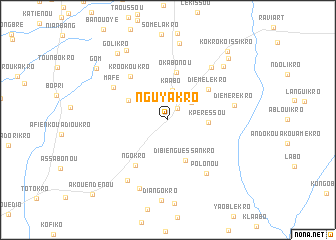
Nguyakro (Cote d'Ivoire)Nguyakro is a town in Cote d'Ivoire. An overview map of the region around Nguyakro is displayed below.
regional and 3d topo map of Nguyakro, Cote d'Ivoire ::
Nguyakro airports ::
The nearest airport is BYK - Bouake, located 47.8 km north of Nguyakro.
Other airports nearby include ASK - Yamoussoukro (61.3 km south west), DJO - Daloa (173.4 km west), Nearby towns ::
Sénikro (1.6km north east) //
Assenkro (3.2km north west) //
Nakouamikro (3.2km north east) //
Kaabo (3.3km north) //
Kpéressou (4.5km east) //
Dibié-Nguessankro (4.9km south east) //
Akromiopla (4.9km north west) //
Okabonou (5.4km north) //
Diémélékro (5.6km north east) //
Ngokro (6.2km south west) //
Kro-Okoukro (6.4km north west) //
Mafé (7.1km north west) //
Polonou (7.3km south east) //
Akafoukro (7.5km north east) //
Diémérékro (7.6km east) //
Makouenkro (8.0km south west) //
Tolabonou (8.3km south) //
Kotobrinoi (8.6km north east) //
Assé-Blé-Ndoukro (8.7km north) //
Ali-Alikro (9.0km north west) //
Golikro (9.3km north west) //
Boungué (9.6km north east) //
Gom (9.8km north west) //
Kokro-Koissikro (10.1km north east) //
Akoue Ndénou (11.8km south west) //
[all distances 'as the bird flies' and approximate] 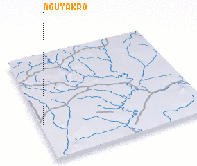 Places with similar names to Nguyakro, Cote d'Ivoire :: Disclaimer :: Information on this page comes without warranty of any kind |
||
|
Where is Nguyakro? Elevation and coordinates ::
Latitude (lat): 7°18'51"N Longitude (lon): 4°59'36"W
Elevation (approx.): 229m (map arrows pan, magnifying glasses zoom) |
||
|
Visiting Nguyakro? Hotel/Accommodation ::
Book a hotel in Nguyakro Travel Guide ::
rental cars ::
car rental offers GPS waypoint ::
download a GPX waypoint (PoI) of Nguyakro for your GPS receiver
|
||