|
search place name
|
||
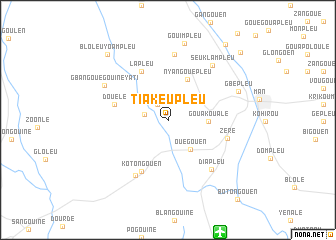
Tiakeupleu (Cote d'Ivoire)Tiakeupleu is a town in Cote d'Ivoire. An overview map of the region around Tiakeupleu is displayed below.
regional and 3d topo map of Tiakeupleu, Cote d'Ivoire ::
Tiakeupleu airports ::
The nearest airport is MJC - Man, located 13.7 km south east of Tiakeupleu.
Other airports nearby include DJO - Daloa (144.5 km south east), Nearby towns ::
Samapleu (2.0km north west) //
Bogouiné (2.7km west) //
Ouegouen (4.1km south east) //
Gouakoualé (4.5km east) //
Nyangouépleu (5.0km north east) //
Douélé (6.1km west) //
Lapleu (6.2km north west) //
Kotongouen (6.4km south west) //
Zéré (6.9km east) //
Banhoukouma (7.2km south west) //
Bangouale (7.3km north) //
Diapleu (7.3km south east) //
Seuklampleu (7.8km north east) //
Gbangouégouiné Yati (8.0km north west) //
Gbépleu (8.4km east) //
Gouimpleu (8.7km north) //
Bloleuyoampleu (9.8km north west) //
Biakéleu (9.8km north west) //
Yébegouen (10.6km north east) //
Gouétita (11.0km north east) //
Botongouen (11.8km south east) //
[all distances 'as the bird flies' and approximate] 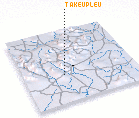 Places with similar names to Tiakeupleu, Cote d'Ivoire ::
// Chikupalle (IN)
// Chikopela (ZM)
// Chikupili (ZM)
// Shakapalu (ZM)
// Chacopalla (PE)
// Chacopalla (PE)
// Chocpallo (PE)
// Choquepal (PE)
// Chucpalla (PE)
// Chakpale (NG)
Disclaimer :: Information on this page comes without warranty of any kind |
||
|
Where is Tiakeupleu? Elevation and coordinates ::
Latitude (lat): 7°23'5"N Longitude (lon): 7°38'23"W
Elevation (approx.): 355m (map arrows pan, magnifying glasses zoom) |
||
|
Visiting Tiakeupleu? Hotel/Accommodation ::
Book a hotel in Tiakeupleu Travel Guide ::
rental cars ::
car rental offers GPS waypoint ::
download a GPX waypoint (PoI) of Tiakeupleu for your GPS receiver
|
||