|
search place name
|
||
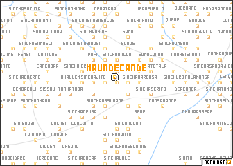
Maundé Candé (Guinea-Bissau)Maundé Candé is a town in Guinea-Bissau. An overview map of the region around Maundé Candé is displayed below.
regional and 3d topo map of Maundé Candé, Guinea-Bissau ::
Maundé Candé airports ::
The nearest airport is BXO - Bissau Oswaldo Vieira Intl, located 146.6 km west of Maundé Candé.
Other airports nearby include TUD - Tambacounda (178.5 km north east), ZIG - Ziguinchor (210.4 km west), FIG - Fira Fria (230.8 km south), KLC - Kaolack (275.4 km north west), Nearby towns ::
Sinchã Samba (0.0km north) //
Gancôli Bilò (1.8km west) //
Iero Uri (1.8km west) //
Cansamba (1.8km east) //
Cumenga (1.9km north) //
Sinchã Aliu Jau (1.8km east) //
Sinchã Bona (1.8km east) //
Sinchã Gêba (2.6km south east) //
Sima (3.6km west) //
Sinchã Jité (3.6km west) //
Sinchã Barbosa (3.6km east) //
Sinchã Ualom (3.7km north) //
Madina Sori (4.1km south west) //
Sinchã Ussumane (4.1km south west) //
Sinchã Demba Ialare (4.1km south west) //
Sinchã Mamadu (4.1km south east) //
Sinchã Bulbuiel (4.1km north west) //
Sinchã Fali (4.1km south east) //
Sinchã Durô Buaro (4.1km north west) //
Contai (4.1km north east) //
Sinchã Bácari (4.1km north east) //
Madina Demba Gano (5.2km south west) //
Sinchã Bambé (5.2km north west) //
Candati Fula (5.2km south east) //
Pófa (5.2km north west) //
Sinchã Cantabá (5.2km north west) //
Áfià (5.2km north west) //
Bravracunda (5.2km north east) //
Dembel Uri (5.4km west) //
[all distances 'as the bird flies' and approximate]  Places with similar names to Maundé Candé, Guinea-Bissau ::
// Mindègon Te (MM)
// Mandakanda (LK)
// Maundeh Kunda (GM)
// Mendy Kunda (GM)
// Minti Kunda (GM)
// Montagnat (FR)
// Mount Kent (AU)
// Montecanto (BO)
// Mount Kennedy (IE)
// Montignat (FR)
Disclaimer :: Information on this page comes without warranty of any kind |
||
|
Where is Maundé Candé? Elevation and coordinates ::
Latitude (lat): 12°17'0"N Longitude (lon): 14°22'0"W
Elevation (approx.): 70m (map arrows pan, magnifying glasses zoom) |
||
|
Visiting Maundé Candé? Hotel/Accommodation ::
Book a hotel in Maundé Candé Travel Guide ::
rental cars ::
car rental offers GPS waypoint ::
download a GPX waypoint (PoI) of Maundé Candé for your GPS receiver
|
||