|
search place name
|
||
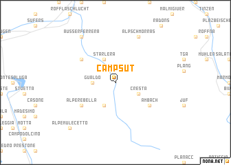
Campsut (Aargau, Switzerland)Campsut is a town in the Aargau region of Switzerland. An overview map of the region around Campsut is displayed below.
regional and 3d topo map of Campsut, Switzerland ::
Campsut airports ::
The nearest airport is SMV - Samedan, located 31.3 km east of Campsut.
Other airports nearby include LUG - Lugano (69.2 km south west), BGY - Bergamo Orio Al Serio (91.6 km south), MXP - Milano Malpensa (111.4 km south west), ACH - St Gallen Altenrhein (111.5 km north), Nearby towns ::
Gualdo (2.6km west) //
Hohenhaus (3.9km south) //
Cresta (3.2km south east) //
Starlera (3.9km north) //
Am Bach (5.3km south east) //
Alpe Rebella (5.3km south west) //
Innerferrera (5.3km north west) //
Alp Schmorras (7.8km north) //
Ausserferrera (8.3km north west) //
Alpe Mulecetto (9.0km south west) //
[all distances 'as the bird flies' and approximate] 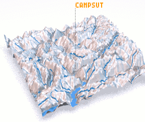 Places with similar names to Campsut, Switzerland ::
// Campo Siete (PH)
// Kempside (US)
// Campo Siete (MX)
// Campo Siete (HN)
// Guampucito (HN)
// Gompa City (LR)
// Campista (BR)
Disclaimer :: Information on this page comes without warranty of any kind |
||
|
Where is Campsut? Elevation and coordinates ::
Latitude (lat): 46°29'0"N Longitude (lon): 9°29'0"E
Elevation (approx.): 1913m (map arrows pan, magnifying glasses zoom) |
||
|
Visiting Campsut? Hotel/Accommodation ::
Book a hotel in Campsut Travel Guide ::
Buy a travel guide for Switzerland rental cars ::
car rental offers GPS waypoint ::
download a GPX waypoint (PoI) of Campsut for your GPS receiver
|
||