|
search place name
|
||
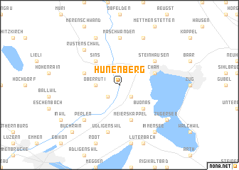
Hünenberg (Aargau, Switzerland)Hünenberg is a town in the Aargau region of Switzerland. An overview map of the region around Hünenberg is displayed below.
regional and 3d topo map of Hünenberg, Switzerland ::
Hünenberg airports ::
The nearest airport is ZRH - Zurich, located 34.6 km north of Hünenberg.
Other airports nearby include BRN - Bern Belp (75.3 km west), MLH - Bale Mulhouse (81.8 km north west), ZQL - Donaueschingen Villingen (90.0 km north), ACH - St Gallen Altenrhein (93.4 km north east), Nearby towns ::
Rotkreuz (2.2km south east) //
Dietwil (2.2km south west) //
Oberrüti (2.5km west) //
Sins (4.5km north west) //
Buonas (4.5km south east) //
Meierskappel (5.7km south) //
Cham (4.2km north east) //
Aettenschwil (4.2km north west) //
Steinhausen (5.3km north east) //
Maschwanden (7.4km north) //
Udligenswil (7.5km south) //
Perlen (6.7km south west) //
Rüstenschwil (6.7km north west) //
Auw (6.7km north west) //
Knonau (7.8km north) //
Mühlau (7.8km north) //
Zugersee (7.5km south east) //
Immensee (8.3km south east) //
Buchrain (9.0km south west) //
[all distances 'as the bird flies' and approximate]  Places with similar names to Hünenberg, Switzerland ::
// Hahnenberg (DE)
// Hahnenberg (DE)
// Hahnenberg (DE)
// Hahnenberg (DE)
// Hahnenberg (DE)
// Hennenberg (DE)
// Hanenberg (NL)
// Hinnenburg (DE)
// Hanenberg (BE)
Disclaimer :: Information on this page comes without warranty of any kind |
||
|
Where is Hünenberg? Elevation and coordinates ::
Latitude (lat): 47°10'0"N Longitude (lon): 8°25'0"E
Elevation (approx.): 448m (map arrows pan, magnifying glasses zoom) |
||
|
Visiting Hünenberg? Hotel/Accommodation ::
Book a hotel in Hünenberg Travel Guide ::
Buy a travel guide for Switzerland rental cars ::
car rental offers GPS waypoint ::
download a GPX waypoint (PoI) of Hünenberg for your GPS receiver
|
||