|
search place name
|
||
Mervelier (Aargau, Switzerland)Mervelier is a town in the Aargau region of Switzerland. An overview map of the region around Mervelier is displayed below.
regional and 3d topo map of Mervelier, Switzerland ::

Mervelier airports ::
The nearest airport is MLH - Bale Mulhouse, located 26.9 km north of Mervelier.
Other airports nearby include BRN - Bern Belp (48.5 km south), ZRH - Zurich (81.4 km east), CMR - Colmar Houssen (85.0 km north), ZQL - Donaueschingen Villingen (104.4 km north east), Nearby towns ::
Vermes (2.2km south west) //
Bärschwil (3.9km north) //
Wahlen (5.7km north) //
Erschwil (4.2km north east) //
Büsserach (5.3km north east) //
Vicques (5.0km west) //
Laufen (7.5km north) //
Schelten (5.4km east) //
Liesberg (6.7km north west) //
Breitenbach (7.5km north east) //
Brislach (8.3km north east) //
Welschenrohr (8.3km south east) //
Grandval (9.0km south west) //
Corcelles (9.0km south west) //
[all distances 'as the bird flies' and approximate] 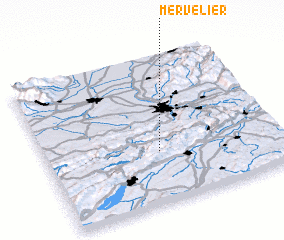 Places with similar names to Mervelier, Switzerland ::
// Maruflar (TR)
// Miraflor (ES)
// Marfilar (VE)
// Marfilar (VE)
// Río Marivela (VE)
// Merviller (FR)
// Moriviller (FR)
Disclaimer :: Information on this page comes without warranty of any kind |
||
|
Where is Mervelier? Elevation and coordinates ::
Latitude (lat): 47°21'0"N Longitude (lon): 7°29'0"E
Elevation (approx.): 548m (map arrows pan, magnifying glasses zoom) |
||
|
Visiting Mervelier? Hotel/Accommodation ::
Book a hotel in Mervelier Travel Guide ::
Buy a travel guide for Switzerland rental cars ::
car rental offers GPS waypoint ::
download a GPX waypoint (PoI) of Mervelier for your GPS receiver
|
||